Types of Maps (College Board AP® Human Geography): Study Guide

Types of maps
The two main categories of maps are reference maps and thematic maps
Reference maps
Reference maps are informational and show where something is in space
The function of reference maps is to display geographical data and information
Reference maps display physical and man-made features
Examples of reference maps include political maps, evacuation routes, and topographical maps

Thematic maps
Thematic maps tell a story about a place by showing quantitative data
There are five types of thematic maps:
Choropleth maps
Dot distribution maps
Graduated symbol maps
Isoline maps
Cartograms
Choropleth maps
Choropleth maps use tone or color to represent spatial data

Dot distribution maps
Dot distribution maps show the distribution of something across a map, with each dot representing a specific quantity. For example, the number of towns

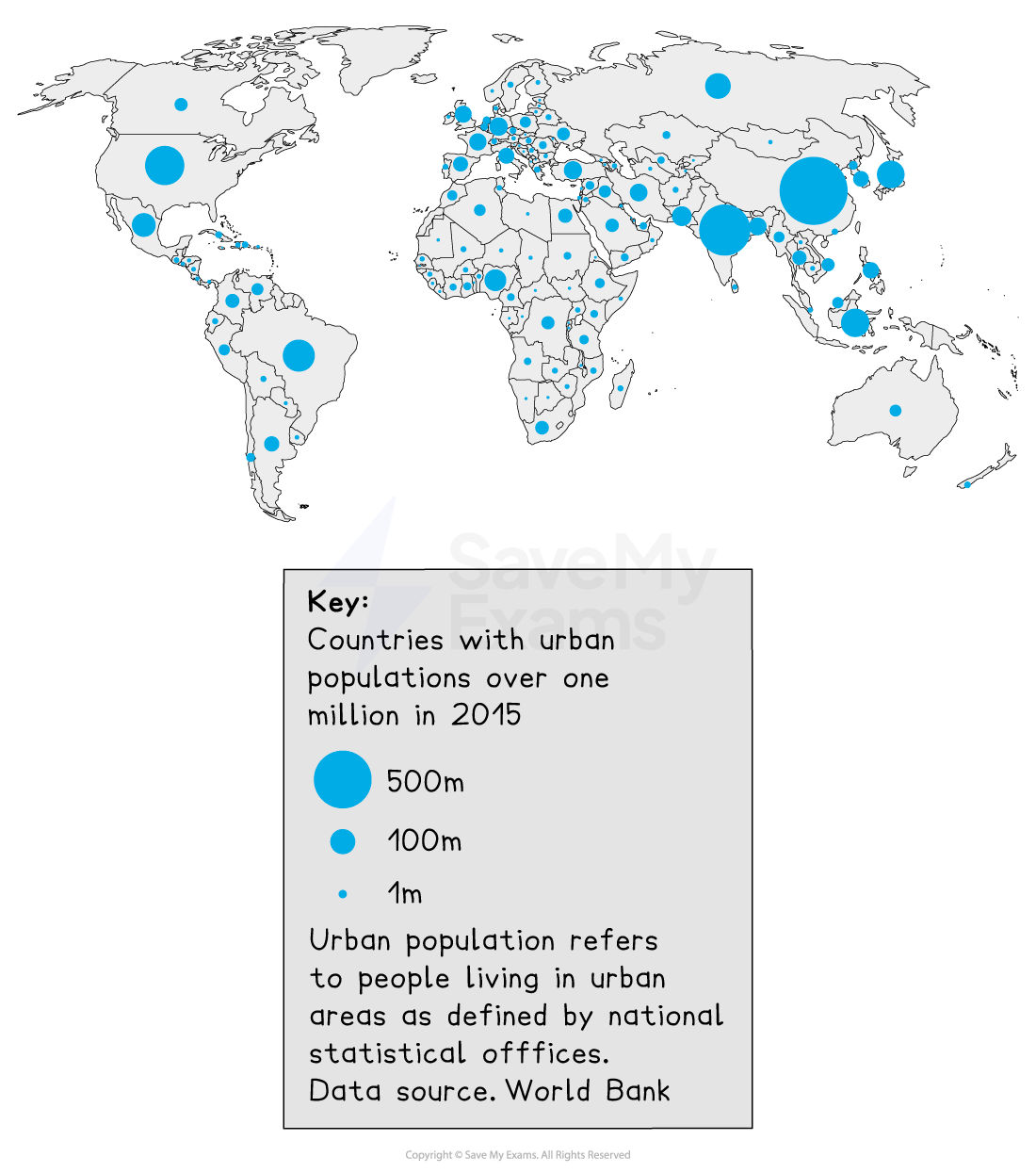
Graduated symbol maps
Graduated symbol maps use symbols of different sizes to indicate different amounts of something, for example, urban population
Isoline maps
Isoline maps use lines to connect points of equal value
Common examples of isoline maps are topographic maps and weather maps

Cartograms
Cartograms display information by distorting the size or shape of a place in proportion to the data represented
In the example below, each grid square represents 1 million people
Image: Topographic map showing elevation

Examiner Tips and Tricks
The AP Exam will often ask you to identify the type of map used as the first question of a multi-part free-response question. You should be able to identify each type of map by name.

Unlock more, it's free!
Did this page help you?
