1
1 mark
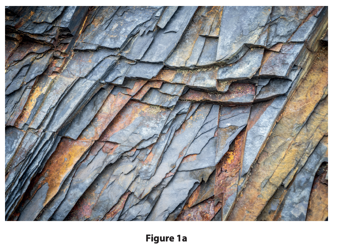
The UK’s landscape is made up of different rock types.
Study Figure 1a in the Resource Booklet.
Identify the rock type shown in Figure 1a.
basalt
granite
sandstone
slate
Was this exam question helpful?
Exam code: 1GA0
The UK’s landscape is made up of different rock types.
Study Figure 1a in the Resource Booklet.
Identify the rock type shown in Figure 1a.
basalt
granite
sandstone
slate
Was this exam question helpful?
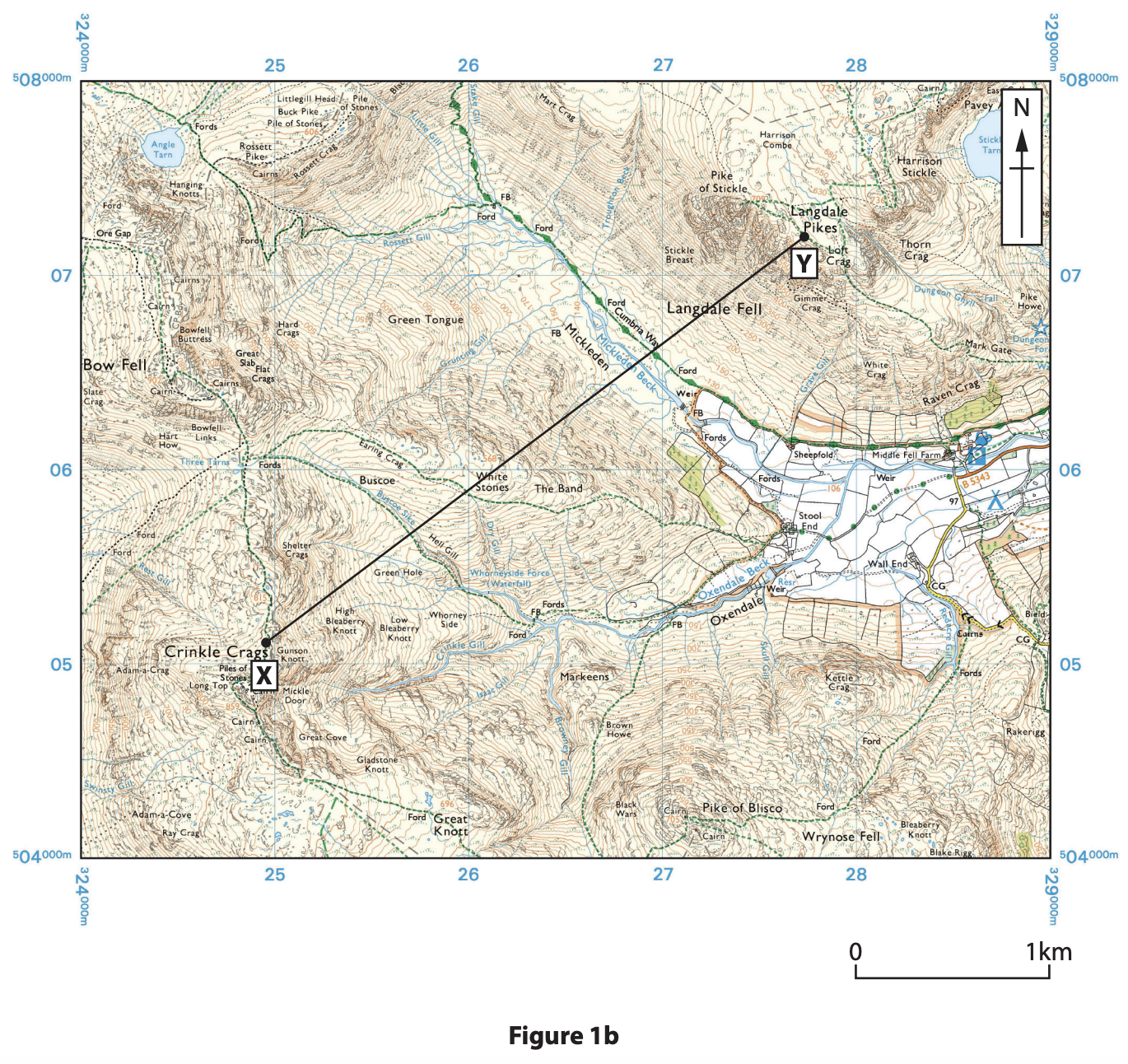
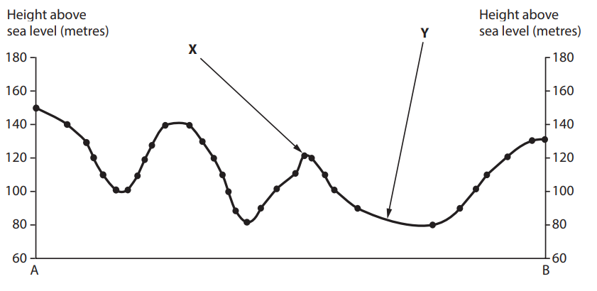
Study Figure 1b in the Resource Booklet.
Calculate the width of the valley between X and Y.
Answer to one decimal place.
You must show your working in the space below.
............................... km
Identify the feature located in grid square 2407.
Angle Tarn
Langdale Pikes
Oxendale Beck
Raven Crag
Was this exam question helpful?
Explain one way in which weathering affects landscapes
Was this exam question helpful?
The UK’s landscape is made up of different rock types.
Identify which one of the following is an igneous rock.
basalt
chalk
sandstone
slate
State one characteristic of igneous rocks.
Was this exam question helpful?
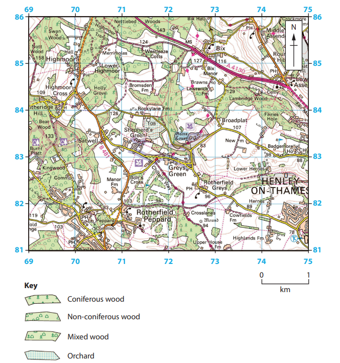
Figure 1
A lowland landscape in Oxfordshire, England
Study Figure 1 in the Resource Booklet.
Identify the type of woodland in grid square 7084.
Name the settlement at 723828.
Was this exam question helpful?
Explain one way that geology has affected the development of UK landscapes
Was this exam question helpful?
UK landscapes are constantly being changed by different processes.
Name one type of metamorphic rock.
State one characteristic of a sedimentary rock.
Explain one reason why igneous rocks often have large crystals.
Was this exam question helpful?
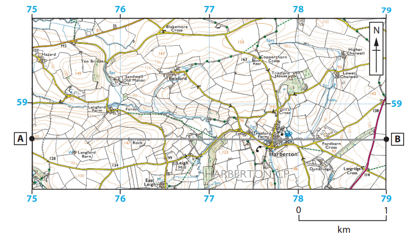
Figure 1a
An area in Devon, England
Key for Figure 1a
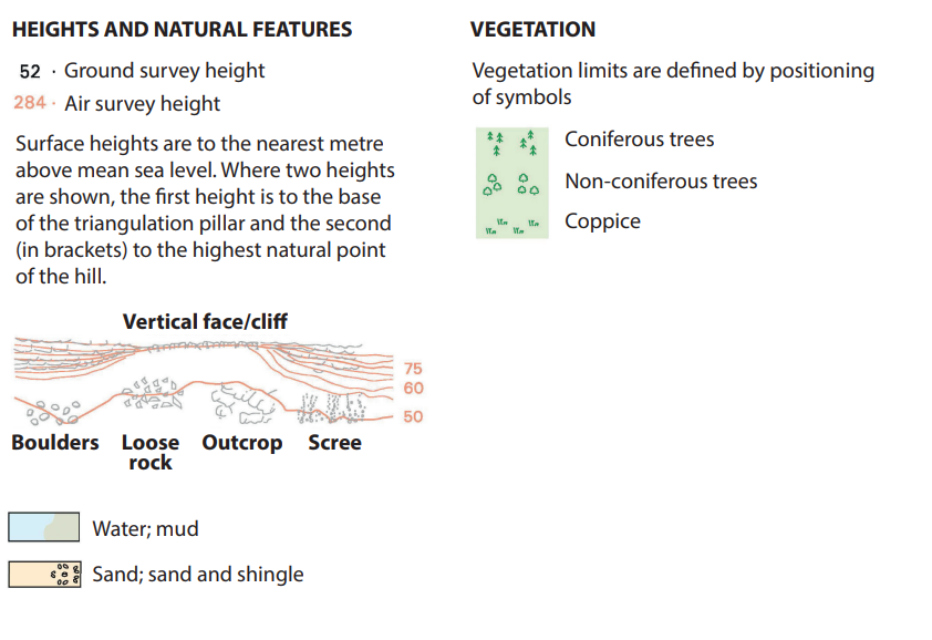
Study Figure 1a in the Resource Booklet.
Figure 1b below is a cross section from 750586 to 790586.
Identify the land use at X.
buildings
railway
woodland
youth hostel
Identify the settlement at Y.
Was this exam question helpful?