1
1 mark
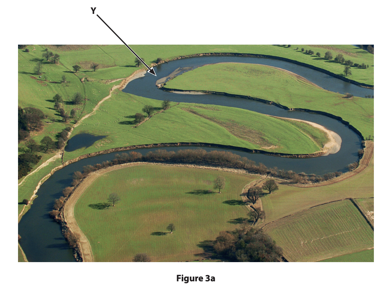
River landscapes are constantly being changed by different processes.
Study Figure 3a in the Resource Booklet.
Identify landform Y
Was this exam question helpful?
Exam code: 1GA0
River landscapes are constantly being changed by different processes.
Study Figure 3a in the Resource Booklet.
Identify landform Y
Was this exam question helpful?
Define the term saltation
Was this exam question helpful?
Explain one reason why sediment shape usually becomes more rounded downstream
Was this exam question helpful?
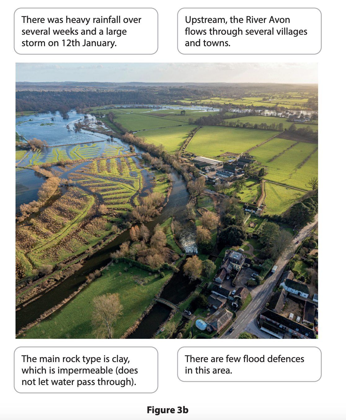
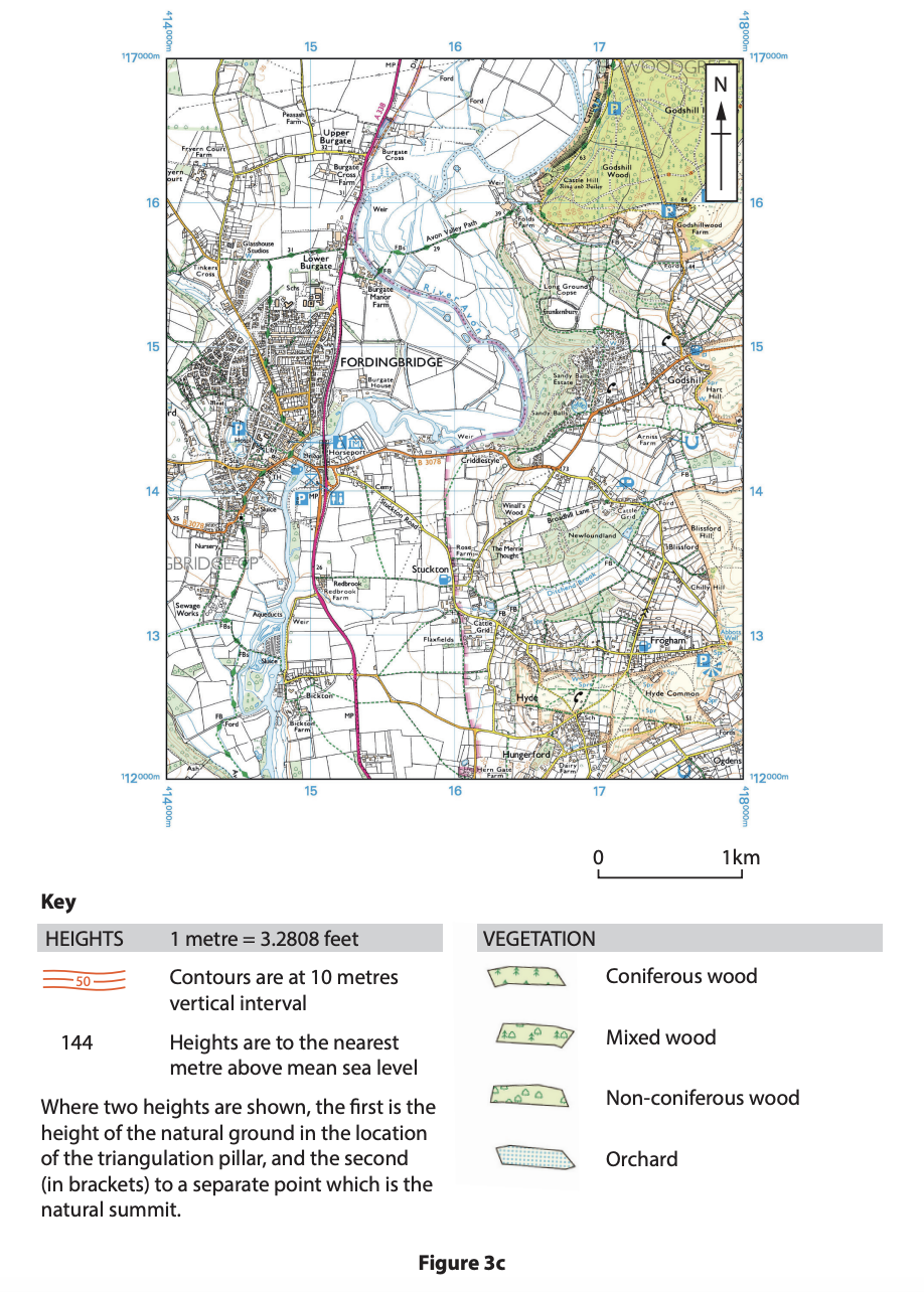
Study Figures 3b and 3c in the Resource Booklet.
Examine the causes of the river flooding shown in Figures 3b and 3c.
You must use evidence from Figures 3b and 3c in your answer
Was this exam question helpful?
River landscapes are constantly being changed by different processes.
Name one type of erosion.
Was this exam question helpful?
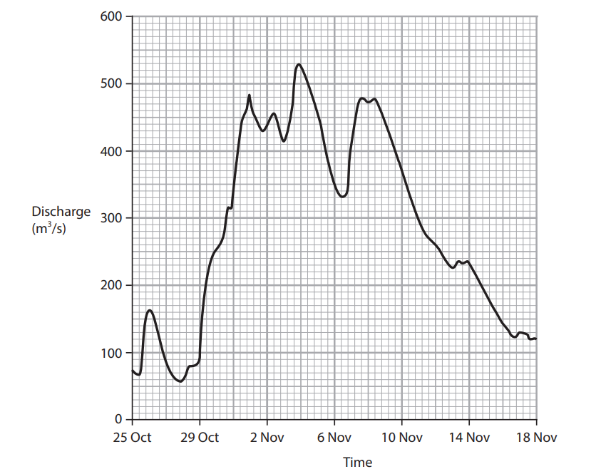
Figure 3a
Discharge for the River Ouse, England
Study Figure 3a in the Resource Booklet.
Identify the peak discharge shown on Figure 3a.
200 m3 /s
320 m3 /s
420 m3 /s
530 m3 /s
Was this exam question helpful?
Explain one reason why there is a lag time between peak rainfall and peak discharge following a storm.
Was this exam question helpful?
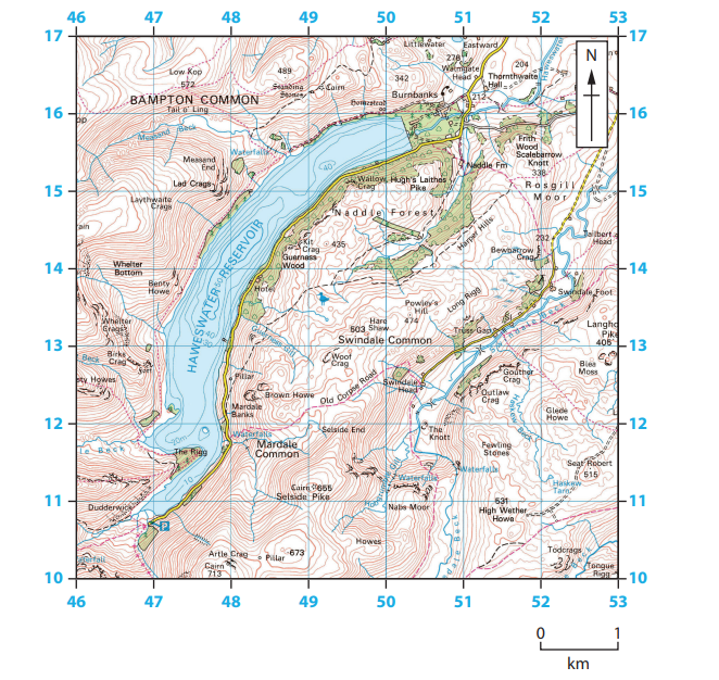
Figure 3b
Haweswater reservoir in the Lake District, England
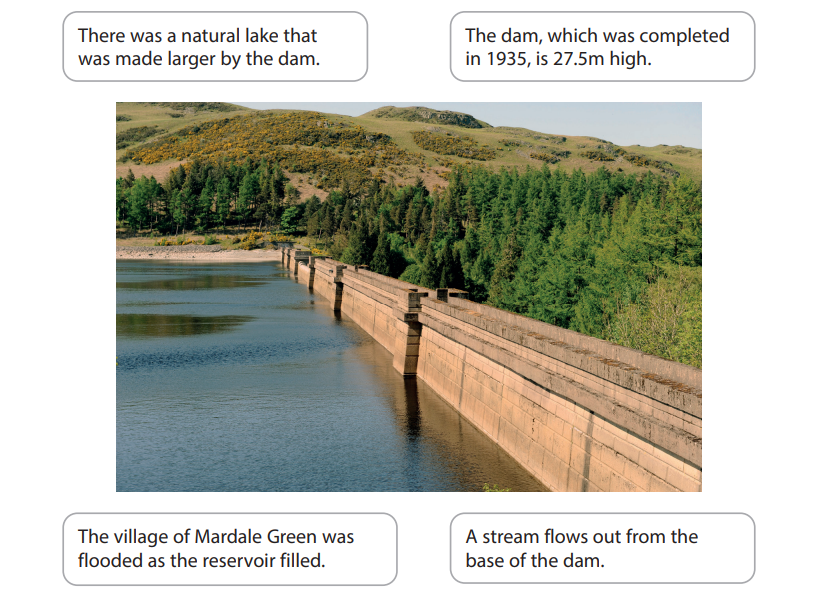
Figure 3c
Haweswater dam in the Lake District, England
Study Figures 3b and 3c in the Resource Booklet.
Examine the possible advantages and disadvantages of the reservoir and dam shown in Figures 3b and 3c.
You must use evidence from Figures 3b and 3c in your answer.
Was this exam question helpful?
Explain one way your investigation helped you understand how river processes affect people.
Was this exam question helpful?
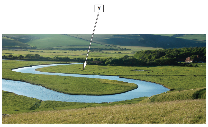
Figure 3a
River Cuckmere, Sussex, England
River landscapes are constantly being changed by physical processes.
Study Figure 3a in the Resource Booklet.
Identify landform Y.
flood plain
gorge
interlocking spurs
oxbow lake
Was this exam question helpful?
State one type of sediment transportation process.
Was this exam question helpful?
Explain one reason why sediment size usually decreases downstream.
Was this exam question helpful?
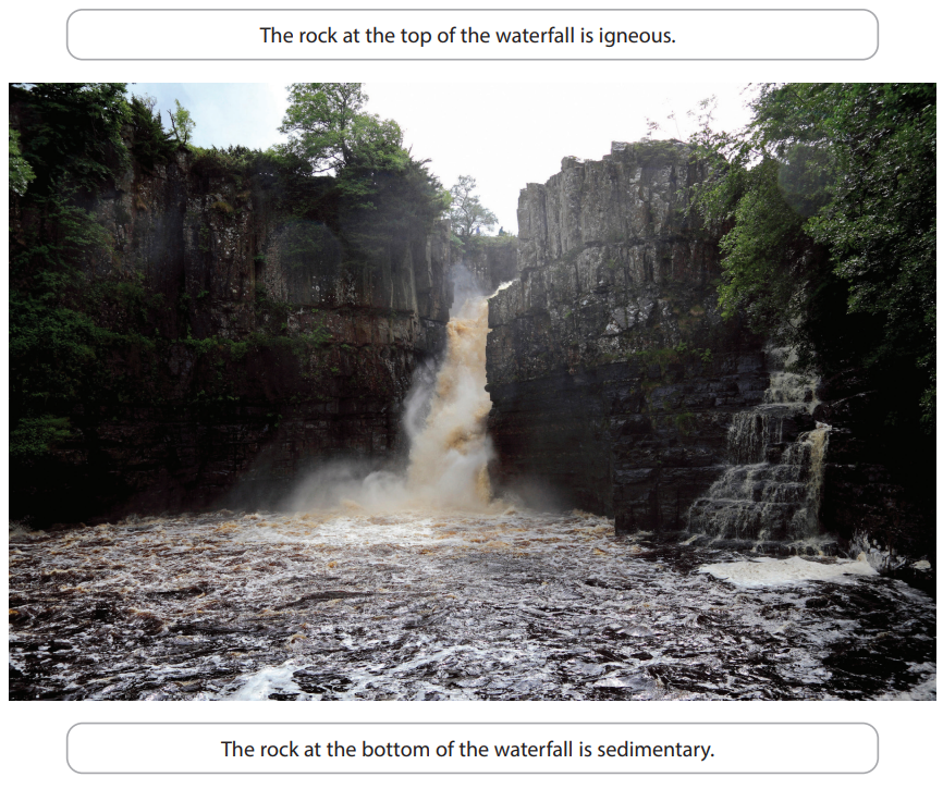
Figure 3b
High Force waterfall, River Tees, England
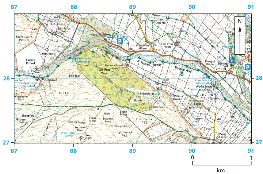
Figure 3c
Location of High Force waterfall
Study Figures 3b and 3c in the Resource Booklet.
Examine the role of erosion processes and geology in the formation of the waterfalls and gorge shown in Figures 3b and 3c.
Was this exam question helpful?