1
6 marks
Figure 2 shows information about average annual sea surface temperatures for 1980 to 2014, compared to the average global sea surface temperature between 1993 and 2012.
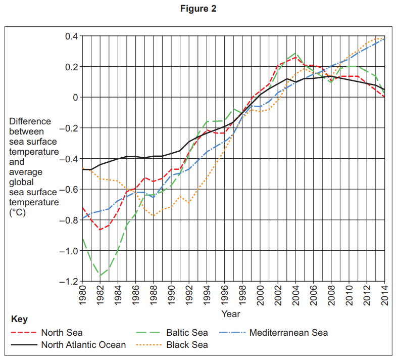
Analyse the information shown in Figure 2.
Was this exam question helpful?