1
6 marks
Explain how vegetation helps stabilise sandy coastlines.
Was this exam question helpful?
Exam code: 8GE0
Explain how vegetation helps stabilise sandy coastlines.
Was this exam question helpful?
Explain two ways that geological structure influences coastal landforms.
Was this exam question helpful?
You have carried out an investigation into coastal landscapes and change.
Assess the value of secondary data at different stages of your geographical investigation.
Geographical enquiry question
Was this exam question helpful?
Name one part of the coastal littoral zone.
Was this exam question helpful?
A group of students collected fieldwork data about cliff profiles at 15 different locations along a section of the north Cornwall coastline.
Study Figure 7
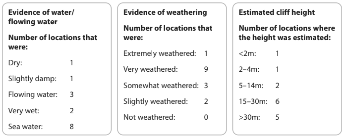
Figure 7
Collated data collection sheets from group fieldwork in an
active coastal landscape in Cornwall
The students then collated their data about water, weathering and estimated cliff height.
Calculate the % of sites where sea water was observed.
Give your answer to one decimal place.
.............................................................. %
The students concluded that the coastal profile was heavily influenced by marine processes.
Suggest one reason why the data shows this might be a sensible conclusion.
Was this exam question helpful?
Study Figure 5a below which shows two samples of nine pebbles on a beach on the east coast of England.
Average size of 9 pebbles at the backshore | Average size of 9 pebbles at the foreshore | |
|---|---|---|
Mean pebble size | 38 | 25 |
Standard deviation | 8.1 | 6.2 |
Figure 5a
Suggest one reason for the difference in pebble size.
Was this exam question helpful?
Study Figure 6
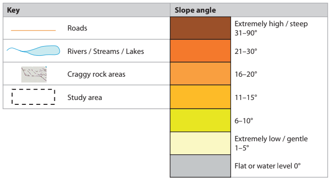
Figure 6
Geographic Information System (GIS) maps showing slope angle
around Southerndown, Glamorgan Heritage Coast, Wales
A group of students used GIS to find secondary information about the relief of the Glamorgan Heritage Coast in South Wales in order to help plan their fieldwork investigation into coastal landscapes.
Identify the most likely type of coastal landscape shown in Figure 6.
Rocky and concordant
Rocky and discordant
Sandy and concordant
Sandy and discordant
Was this exam question helpful?
Explain how the characteristics of coastal plains and rocky coasts differ.
Was this exam question helpful?
Explain how vegetation helps stabilise sandy coastlines.
Was this exam question helpful?
Study Figures 7a, 7b, 7c and 7d
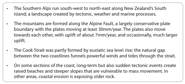
Figure 7a
Information about the coastal landscape of New Zealand
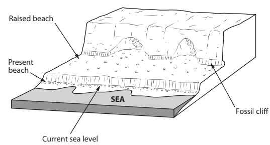
Figure 7b
A simplified cross-section of Turakirae Head
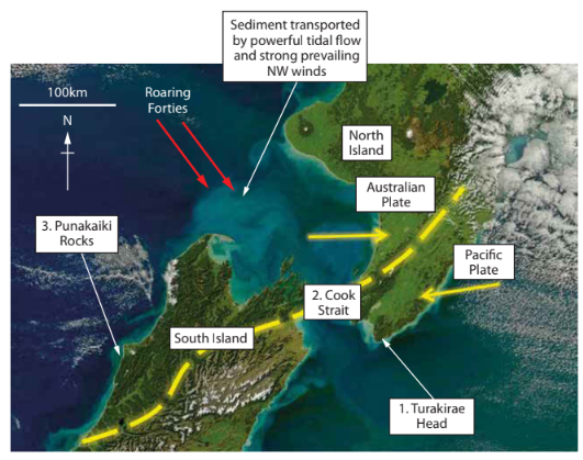
Figure 7c
Satellite image of part of North and South Islands, New Zealand
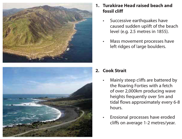
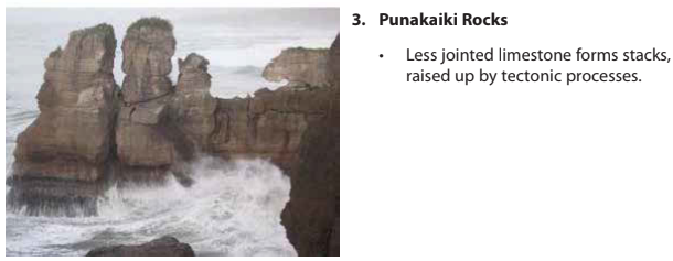
Figure 7d
Distinctive landscapes along New Zealand’s coastline
Evaluate the importance of tectonic and marine processes in creating distinctive coastal landscapes in New Zealand.
Was this exam question helpful?