1
16 marks
Study Figures 4a, 4b, 4c and 4d
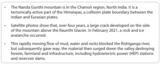
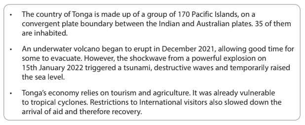
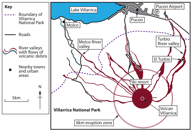
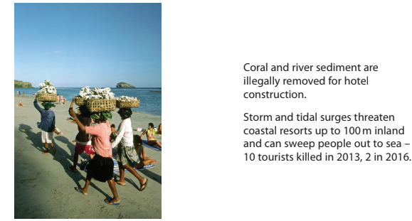
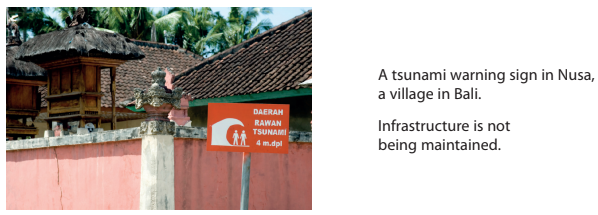
Figure 4a
Information about the cause of the disaster

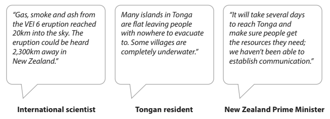
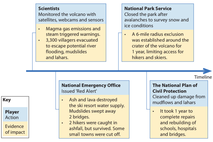
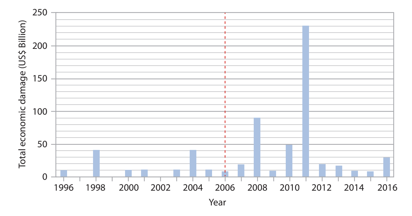
Figure 4b
Three viewpoints about the Chamoli disaster
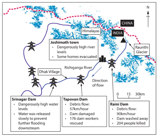
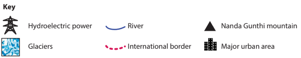
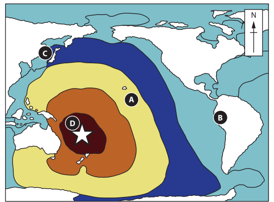
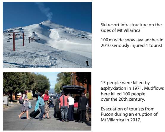
Figure 4c
Selected impacts of the Chamoli disaster in February 2021

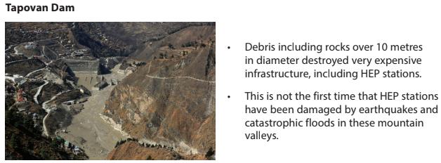
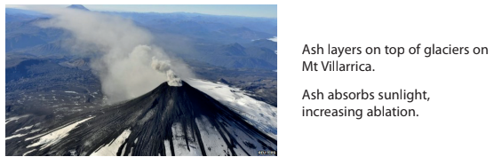
Figure 4d
Three scenes from the Chamoli region, February 2021
Evaluate the relative importance of physical and human factors in causing the Chamoli disaster.
Was this exam question helpful?