1
1 mark
Complete the missing part of the hazard risk equation.
Risk of disaster = ![]()
Was this exam question helpful?
Exam code: 8GE0
Complete the missing part of the hazard risk equation.
Risk of disaster = ![]()
Was this exam question helpful?
Assess the view that the most severe volcanic disasters occur on destructive plate boundaries.
Was this exam question helpful?
State one hazard caused by an earthquake.
Was this exam question helpful?
Study Figure 1b
Ridgecrest is a settlement of 28,000 in a rural part of California, USA. The nearby military base is a major employer and the nearest major city (Los Angeles) is 250km away.
In July 2019 the region experienced a series of earthquakes, the most powerful in 20 years.
July 4th – Magnitude 6.4
July 5th – Magnitude 7.1 (main earthquake)
July 5th – Magnitude 5.4 (strongest aftershock)
The community has struggled to recover from these earthquakes.
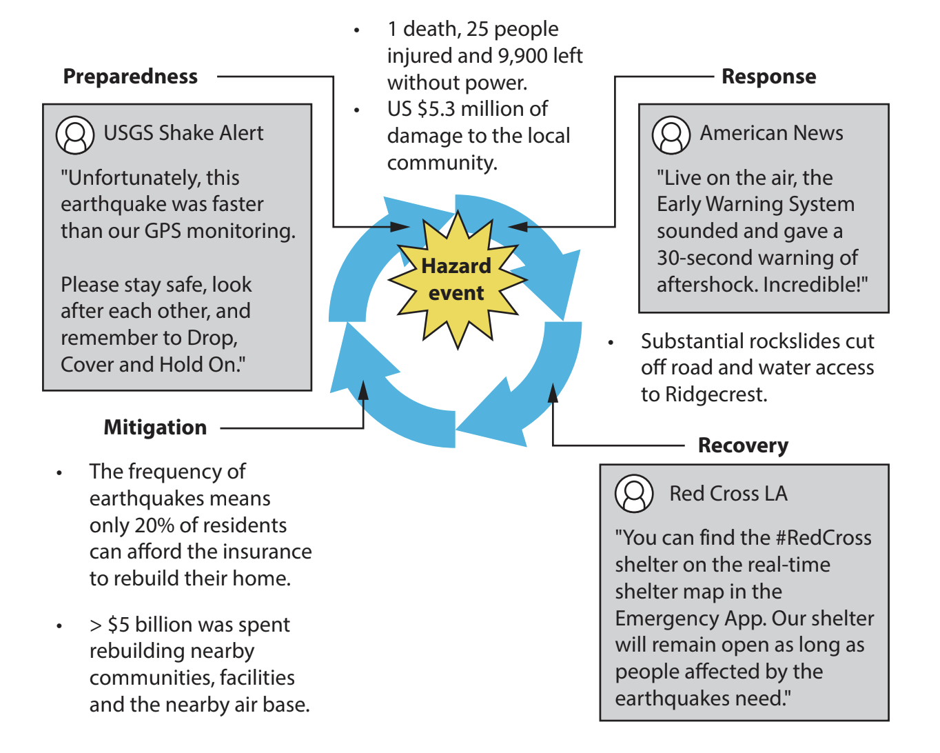
Figure 1b
Information about the Ridgecrest earthquakes, 2019,including selected social media coverage
Assess the effectiveness of strategies used to modify the impact of these earthquakes.
Was this exam question helpful?
State one characteristic of tectonic hazard profiles.
Was this exam question helpful?
Study Figure 1c
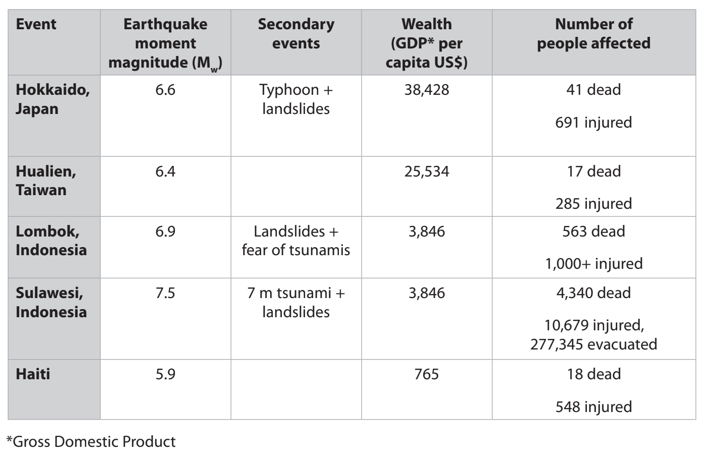
Figure 1c
Data about selected earthquake events in 2018
Assess the extent to which wealth (GDP per capita) affects the impacts of these earthquakes.
Was this exam question helpful?
There are complex interrelationships between a hazard and the community it affects. These can be explained by the Pressure and Release Model.
Explain two parts of this model.
Was this exam question helpful?
Study Figure 1b
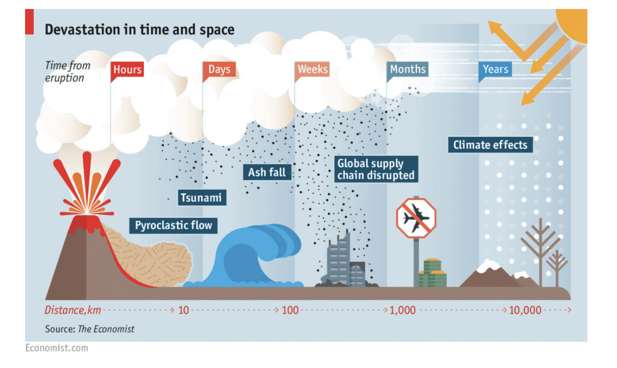
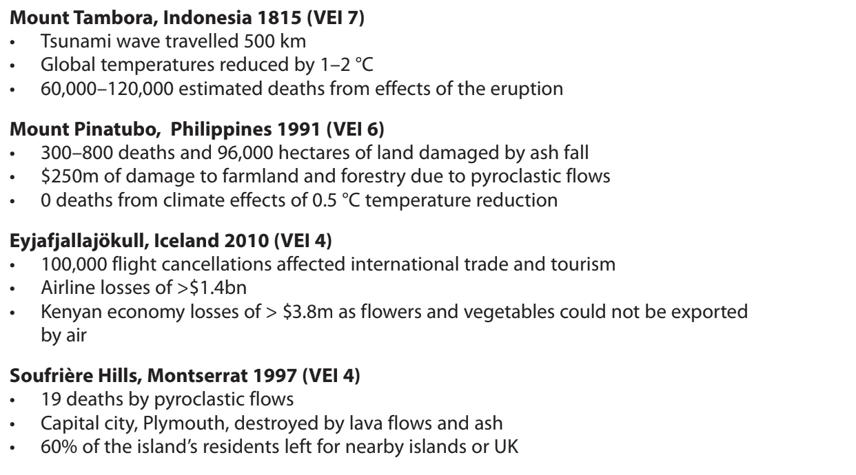
Figure 1b
A simplified interpretation of the areal extent of volcanic eruptions,
and actual data on 4 volcanic disasters
Assess whether areal extent is the most important factor that determines the impact of volcanic eruptions.
Was this exam question helpful?
Study Figure 1
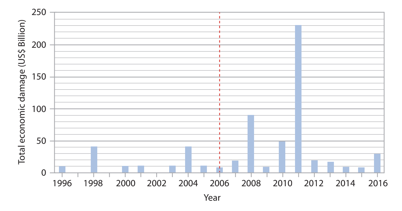
Figure 1
Total reported economic damage caused by tectonic hazards between 1996 and 2016
Suggest one reason for the differences shown.
Was this exam question helpful?