1
1 mark
A variety of processes interact to shape glaciated upland landscapes.
Study Figure 4a in the Resource Booklet.
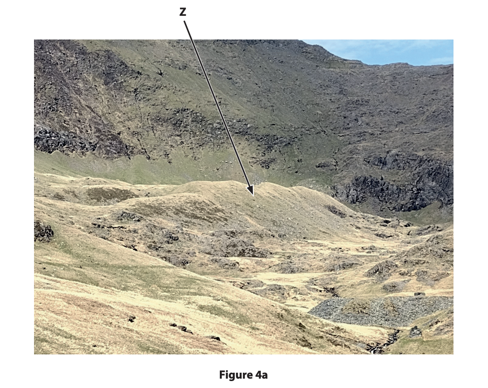
Identify landform Z.
corrie
ground moraine
hanging valley
truncated spur
Was this exam question helpful?
Exam code: 1GA0
A variety of processes interact to shape glaciated upland landscapes.
Study Figure 4a in the Resource Booklet.
Identify landform Z.
corrie
ground moraine
hanging valley
truncated spur
Was this exam question helpful?
Define the term plucking
Was this exam question helpful?
Explain one way that tourism can lead to changes in glaciated upland landscapes.
Was this exam question helpful?
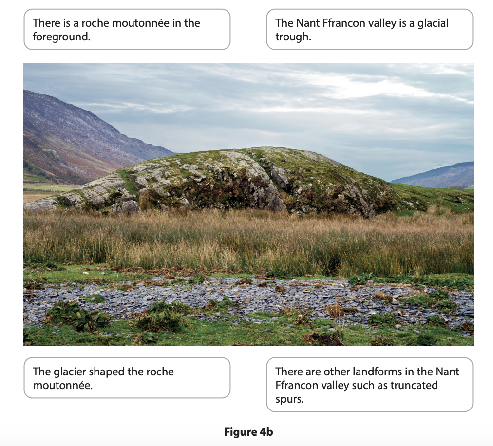
Study Figures 4b and 4c in the Resource Booklet.
Examine the role of erosional and depositional processes in the formation of the glacial landforms shown in Figures 4b and 4c.
You must use evidence from Figures 4b and 4c in your answer.
Was this exam question helpful?
A variety of processes interact to shape glaciated upland landscapes.
Name one type of weathering.
Was this exam question helpful?
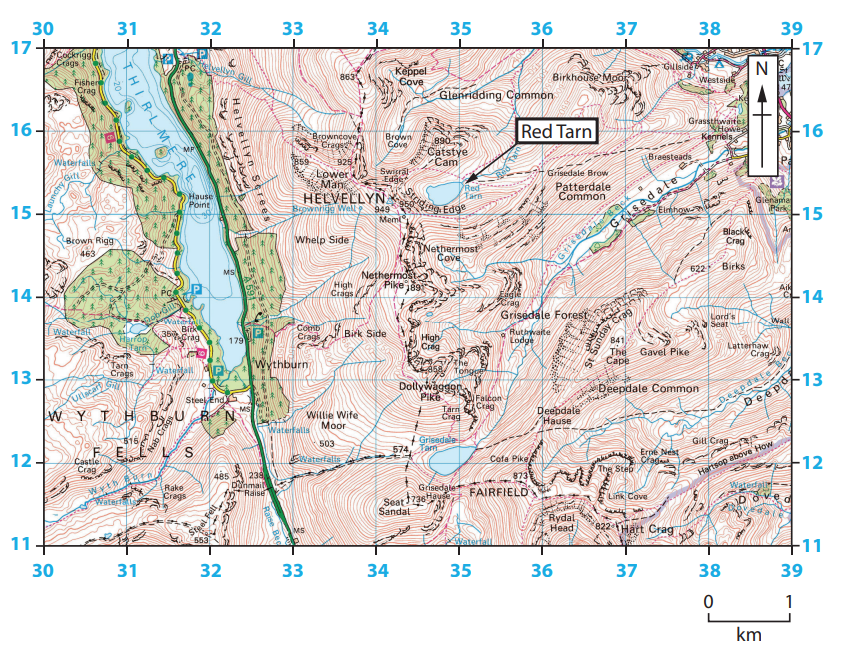
Figure 4a
A glaciated upland landscape in the Lake District, England
Study Figure 4a in the Resource Booklet.
Identify the grid square in which Red Tarn is located.
3412
3415
3613
3115
Was this exam question helpful?
Explain how arêtes are formed.
Was this exam question helpful?
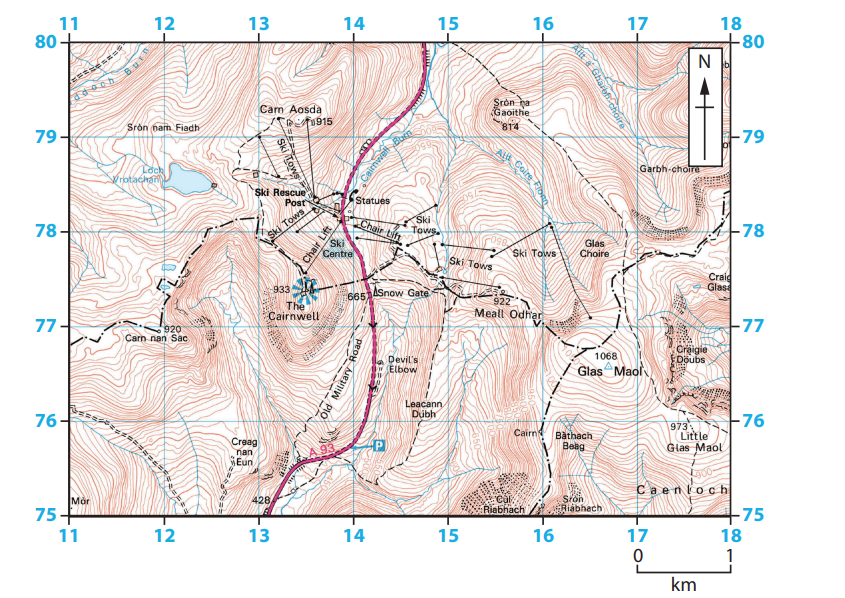
Figure 4b
Glenshee ski resort in the Cairngorms, Scotland
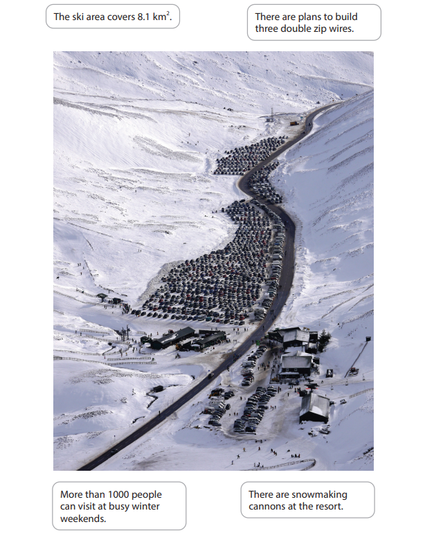
Figure 4c
A view of Glenshee ski resort in the Cairngorms, Scotland
Study Figures 4b and 4c in the Resource Booklet.
Examine the possible advantages and disadvantages of the development of the ski resort shown in Figures 4b and 4c.
You must use evidence from Figures 4b and 4c in your answer.
Was this exam question helpful?
Glaciated upland landscapes are constantly being changed by physical processes.
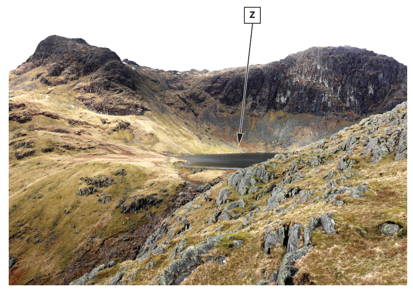
Figure 4a
Stickle Ghyll, Lake District, England
Study Figure 4a in the Resource Booklet.
Identify landform Z.
arête
corrie
drumlin
truncated spur
Was this exam question helpful?
State one type of glacial erosion process.
Was this exam question helpful?
Explain one impact of freeze thaw weathering on landscapes.
Was this exam question helpful?
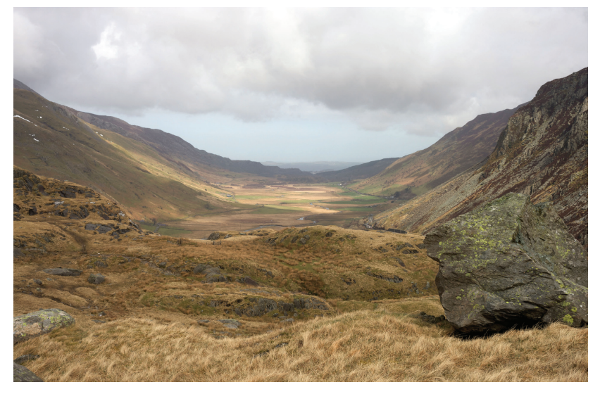
Figure 4b
Nant Ffrancon, a glacial trough in Snowdonia, Wales
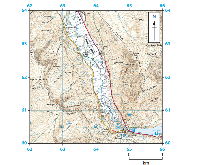
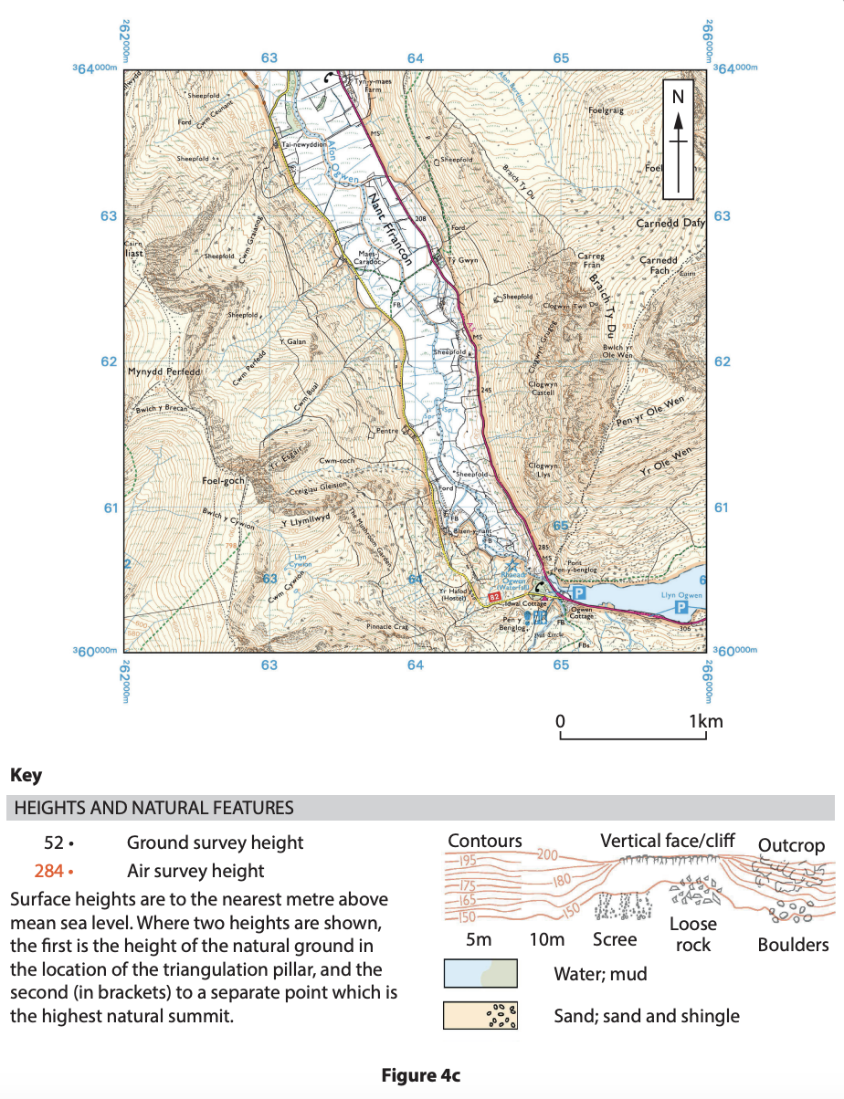
Figure 4c
Location of Nant Ffrancon
Study Figures 4b and 4c in the Resource Booklet.
Examine the role of erosional processes in the formation of the glacial trough shown in Figures 4b and 4c.
Was this exam question helpful?