1
3 marks
Study Figure 2.1.
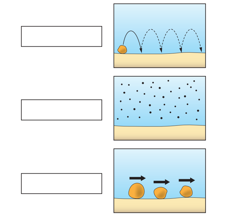
Add the correct labels from the box below to complete Figure 2.1.
hydraulic action traction suspension attrition saltation abrasion |
Was this exam question helpful?
Exam code: C112
Study Figure 2.1.
Add the correct labels from the box below to complete Figure 2.1.
hydraulic action traction suspension attrition saltation abrasion |
Was this exam question helpful?
Name one coastal landform created by the process of deposition.
Give one reason why rock type (geology) can affect the rate of coastal erosion.
Was this exam question helpful?
For one country you have studied, describe the impacts of climate change on coastal communities.
Name of country: .....................................................................................
Give two reasons why ‘hold the line’ is not always popular when managing coastlines.
Was this exam question helpful?
Study Figure 4.
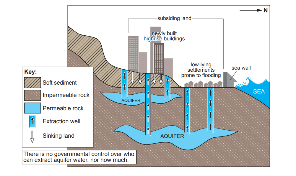
Jakarta’s coast currently receives some protection from seawalls.
Name two benefits of a seawall.
Give two reasons why sea walls might not be a long-term solution.
Was this exam question helpful?
Study Figure 4.
Suggest why Jakarta is sinking.
Was this exam question helpful?
Study Fact File 2.
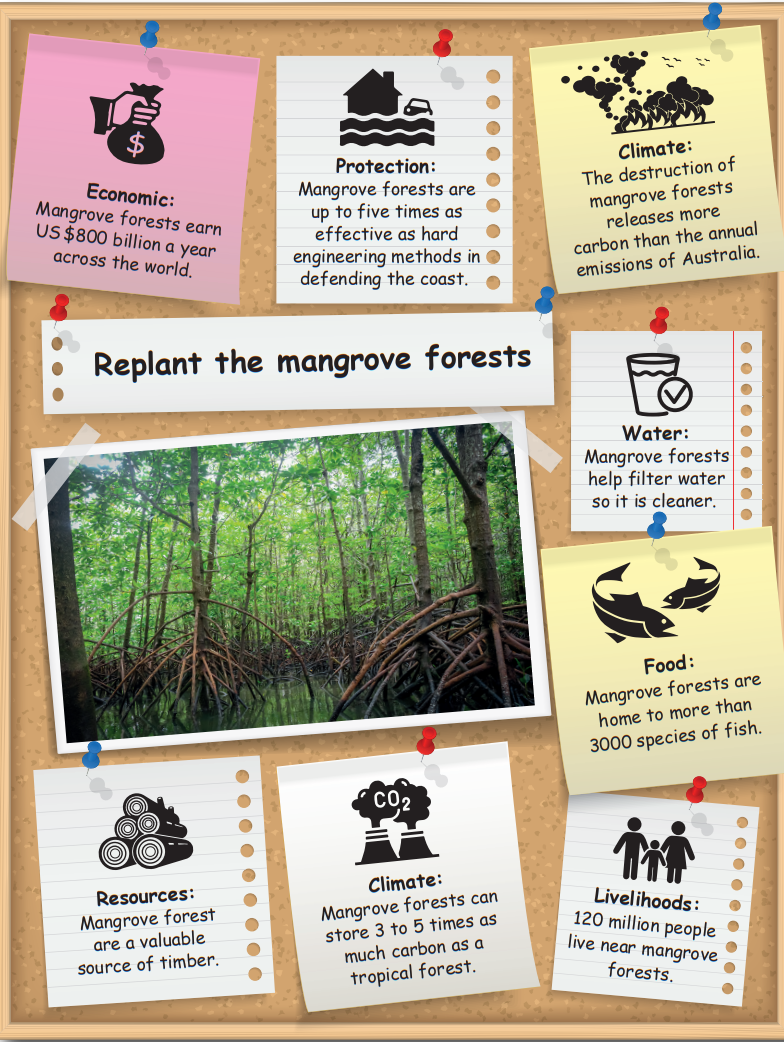
Why might fishermen in Jakarta be in favour of replanting the mangrove forests?
Was this exam question helpful?
Some coastal areas of the UK are under increasing risk of damage through erosion.
Study Figure 2.4.
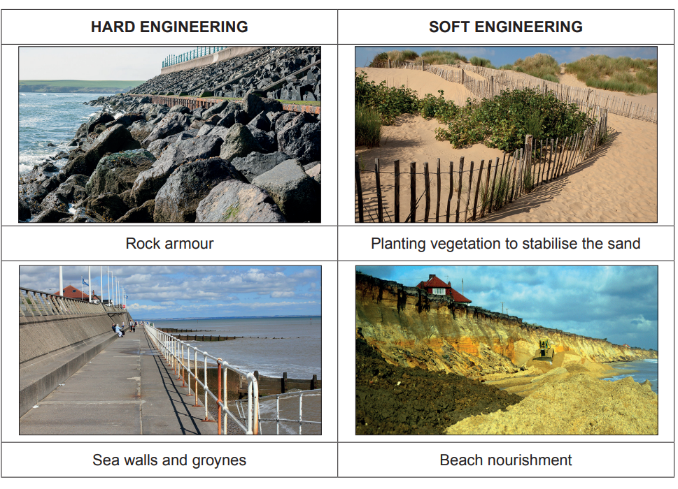
Is hard or soft engineering a more sustainable way of managing UK coastlines? Justify your views.
Was this exam question helpful?
Coastal areas are affected by many different physical processes. Complete the sentences below by adding the correct words from the box.
hydraulic action joints weathering headlands attrition saltation deposition cliffs abrasion |
Some rocks have vertical lines of weakness called ....................................... The breaking down of rock by the wind and rain or by plant roots is called ................................................................ .
The force of waves compressing air into weakness in the cliffs is called ................................................................ .
The process where rocks are picked up by the waves and thrown against the cliffs is called ................................................................ .
Was this exam question helpful?
Figure 2.1 below shows part of the area on the map.
Name the features marked A, B and C on Figure 2.1.
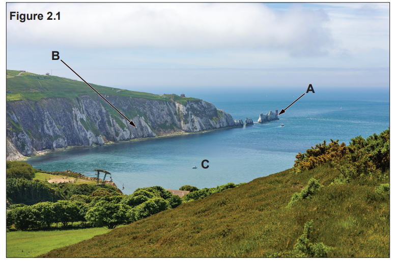
Feature | Letter |
White Cliffs | |
Scratchell’s Bay | |
The Needles | |
Alum Bay | |
West High Down | |
Totland Bay |
Was this exam question helpful?
The Needles are an example of the coastal landform ‘stacks’.
Describe how a stack is formed. You may draw diagrams in the space below to support your answer.
Was this exam question helpful?
Explain one way in which human activity can increase coastal erosion.
To reduce erosion rates some planners support the ‘hold the line’ method of coastal management. Explain why there are conflicting views on this method of coastal management.
Was this exam question helpful?
Study Figure 2.3 below.
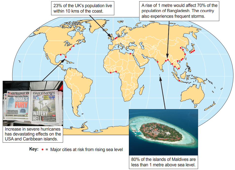
“The increased frequency of storms and rising sea levels will have a greater impact on coastal communities in LICs/NICs compared to HICs.”
How far do you agree with this statement?
Was this exam question helpful?