Cross-Sections & Transects (SQA National 5 Geography): Revision Note
Exam code: X833 75

Written by: Bridgette Barrett
Updated on
Drawing and interpreting cross-sections
A cross-section is a slice through the landscape
They are represented on a map by a line which is often labelled A at one end and B at the other
They use the contour lines to determine the height of the land

A piece of paper is then laid along the line and points A and B are marked on
The contour lines are then marked on each time they cross the paper

These figures can then be used to create the cross-section

Worked Example
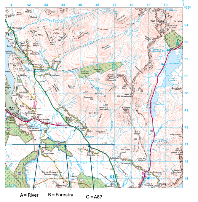
Study Diagrams Q3A, Q3B and the Ordnance Survey map extract (Item A) (opens in a new tab)of the Portree area.
Match the letters A, B and C with the correct features.
Choose from the features below:
River Footpath A87 Forestry
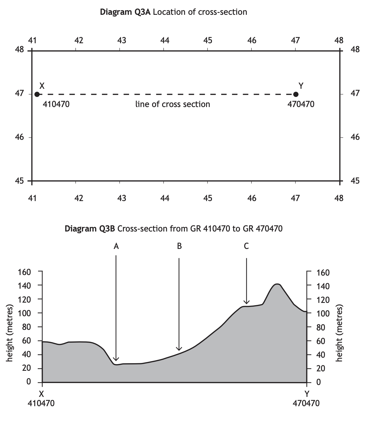
Answer

Unlock more, it's free!
Join the 100,000+ Students that ❤️ Save My Exams
the (exam) results speak for themselves:

Was this revision note helpful?