Grid References (SQA National 5 Geography): Revision Note
Exam code: X833 75

Written by: Bridgette Barrett
Updated on
Four-figure grid references
Four-figure grid references are used to locate specific grid squares within the map
The first two figures are the eastings, which indicate how far east or west a grid is across the map
The second two figures are the northings, which indicate how far north or south a grid is on the map
To find the four-figure grid reference, give the number from the bottom of the map first, then the number from the side

In the image above, the 4-figure grid reference would be 17 51
Ordnance Survey four-figure and six-figure grid references are written as a sequence of numbers without commas between the digits
Six -figure grid references
Six-figure grid references are used to locate exact points within grid squares
The first three figures are the eastings
The second three figures are the northings
To give the 6-figure grid reference, you need to image that the grid square is divided into 100 smaller squares

Examiner Tips and Tricks
In the exam, you are likely to be asked to identify features using grid references to locate them on a map. You need to ensure that you can confidently give and use both four and six-figure grid references.
Practice on any OS map using the steps outlined above.
Worked Example
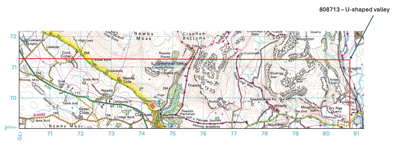
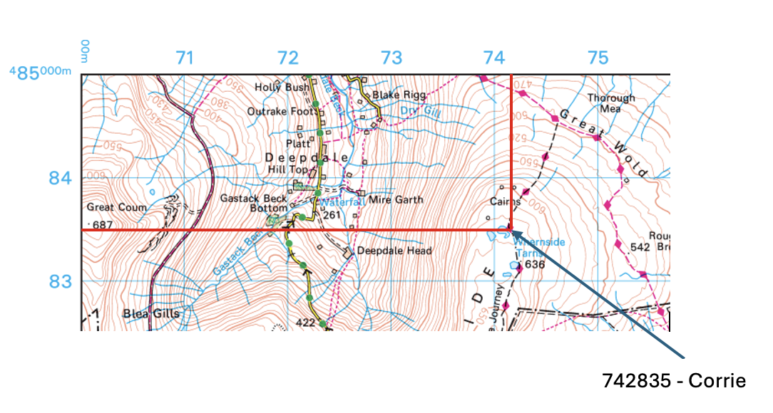
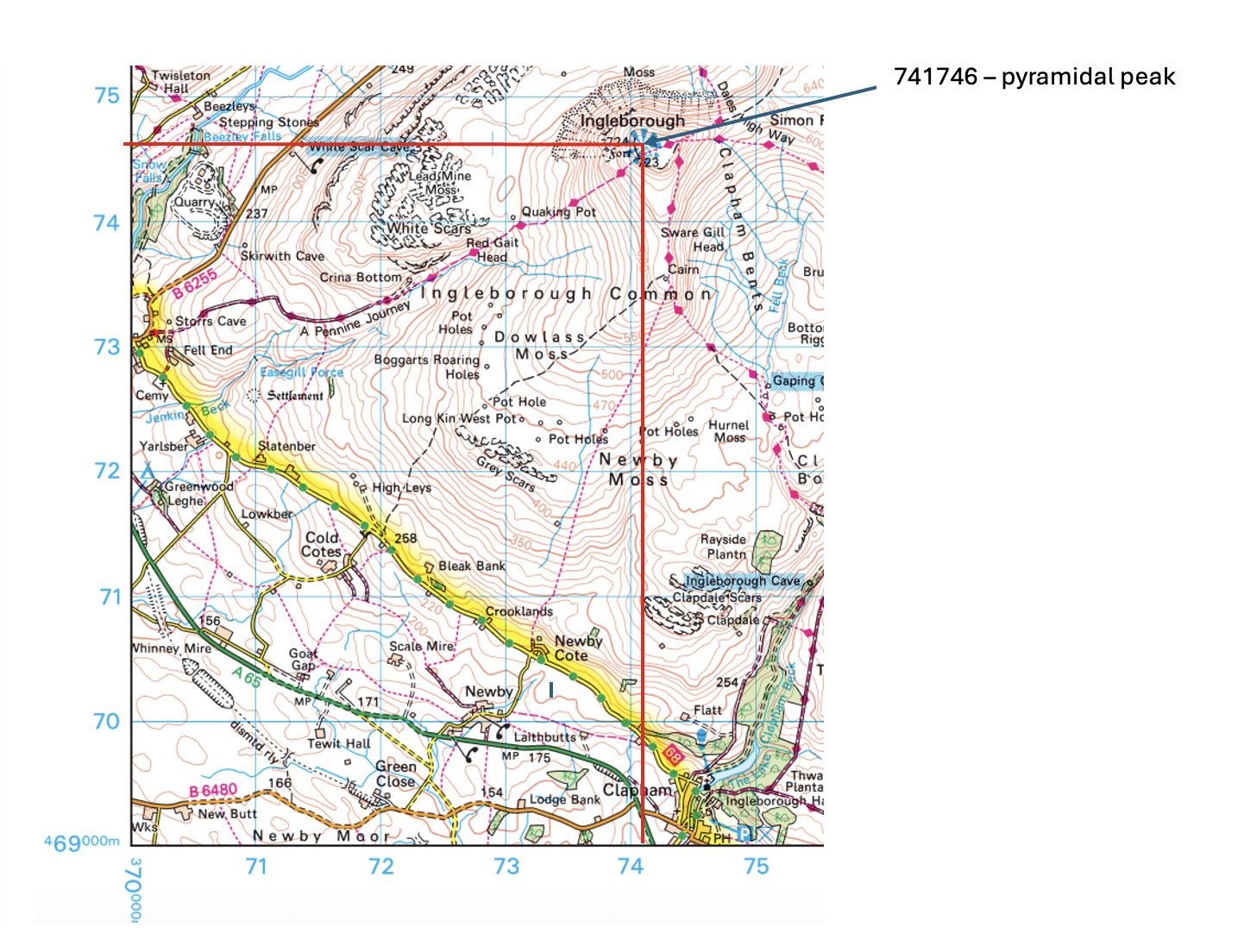
Study the Ordnance Survey map extract (Item A) (opens in a new tab)of the Ingleborough area. Match the glaciated landscape features to the correct grid references.
Features:
U-shaped valley corrie pyramidal peak
Choose from grid references:
741746 825735 808713 742835
Answer

Unlock more, it's free!
Join the 100,000+ Students that ❤️ Save My Exams
the (exam) results speak for themselves:

Was this revision note helpful?