Pictorial Information (SQA National 5 Geography): Revision Note
Exam code: X833 75

Written by: Bridgette Barrett
Updated on
Examiner Tips and Tricks
Fieldsketches and photographs are used throughout the National 5 exam. You may be required to use them on their own or together with an OS map to identify and analyse landscapes.
Fieldsketches
A field sketch is a hand-drawn picture of a place, usually outdoors, made to capture observations and data during fieldwork
It documents features of a landscape, both natural and built, through visuals and notes
Field sketches are qualitative data and help us remember specific locations, details, and observations made during a field study
A successful field sketch should include:
The location or site number
Have a title
Show compass direction
Key features at the site
Strengths
Things can be left out of the sketch if they are not relevant to the enquiry
Helps recall key features
Smaller, important areas can be more detailed
Gives a broad overview of the features
Limitations
The scale in the sketch may be inaccurate
Important details may be missed
The sketch may contain inaccuracies which affect the analysis, for example, more litter than there actually was at the site
Examiner Tips and Tricks
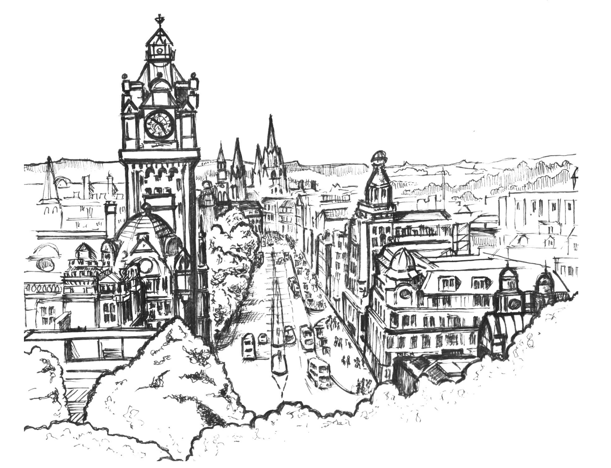
In the exam, you may be given a fieldsketch like the one above that acts as a reminder of information you need to cover in the answer. This one is to remind you of what the CBD is so that you can answer the question about recent changes to a city you have studied.
Photographs
Photographs are used throughout the exam to illustrate both human and physical features
This is about observational skills and understanding of what is being viewed
Things to look for in photographs include:
Physical features: vegetation, climate, relief, drainage, distinct features (cliff, river, desert, landslide, etc.), rocky outcrops, etc.
Human features: groupings of buildings: offices, homes, factories, etc. Urban, rural or fringe settlements. Industry and transport; developed or developing areas and general condition of features: busy, quiet, modern, old, etc.
Relief: height and shape of ground surface, named features, overall appearance
Agriculture: animal type and spread; vegetation type—grass, barren, sparse, etc. Land type: arable or pasture, ploughed or fallow, crops or harvested, etc. Types of farm buildings and machinery, along with their condition
Settlements: rural or urban; features of buildings; types of buildings; use of settlements and buildings; spacing between or among buildings—linear, dispersed, nucleated, etc.
Housing: size and storey: bungalow, large, multistorey, skyscraper, etc., number of windows, are there building plots or vacant sites on the urban fringe or new builds, etc.
Examiner Tips and Tricks
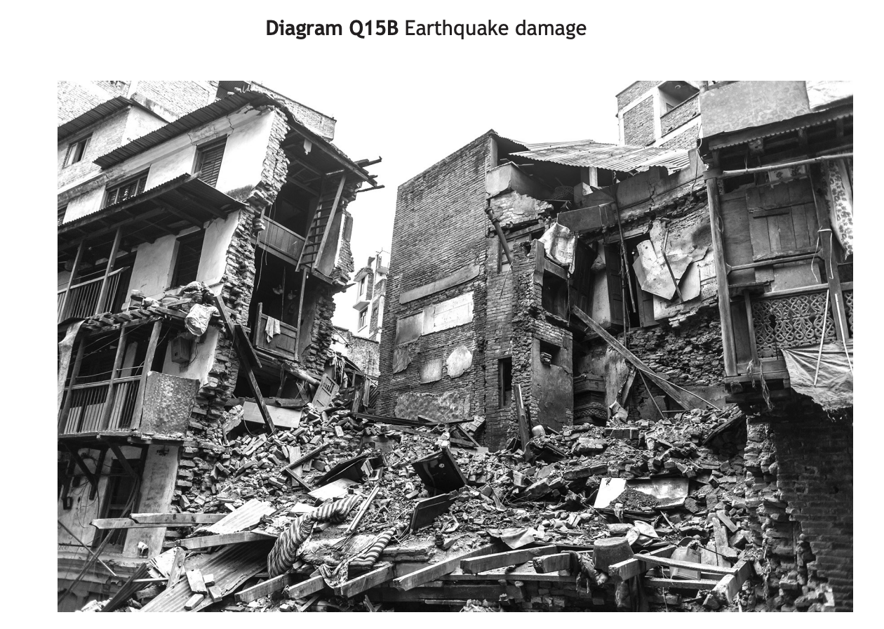
The question linked to this photograph is
"With reference to a named earthquake(s) you have studied, explain the impacts on the people and the landscape."
You can use the photograph to remind you of some of the impacts which you can then explain, including;
Collapsed buildings causing injuries and deaths
Damage to homes leading to homelessness
Damage to infrastructure which affects response times

Unlock more, it's free!
Join the 100,000+ Students that ❤️ Save My Exams
the (exam) results speak for themselves:

Was this revision note helpful?