Scale (SQA National 5 Geography): Revision Note
Exam code: X833 75

Written by: Bridgette Barrett
Updated on
Using scale
Maps in the exam will either be scale 1:25,000 where 1cm on the map = 25,000cm (250m) in real life or 1:50,000 where 1cm = 50,000cm (500m) in real life
When the distance is straight or almost straight, it can either be measured using a ruler or the edge of a straight piece of paper.
Mark distances on a piece of paper using the scale at the bottom of the map.
You can then lay the paper from the first point to the second point to calculate the distance.

A distance along a curved route can be divided, the paper rotated and marked in stages to calculate the full distance
To measure from A to B following the road on the map below, the route can be divided into a series of straight sections using crosses.
Next, use the plain piece of paper to measure from A to the first cross. Next, rotate the paper, pivoting at the cross to mark the second cross.

Worked Example
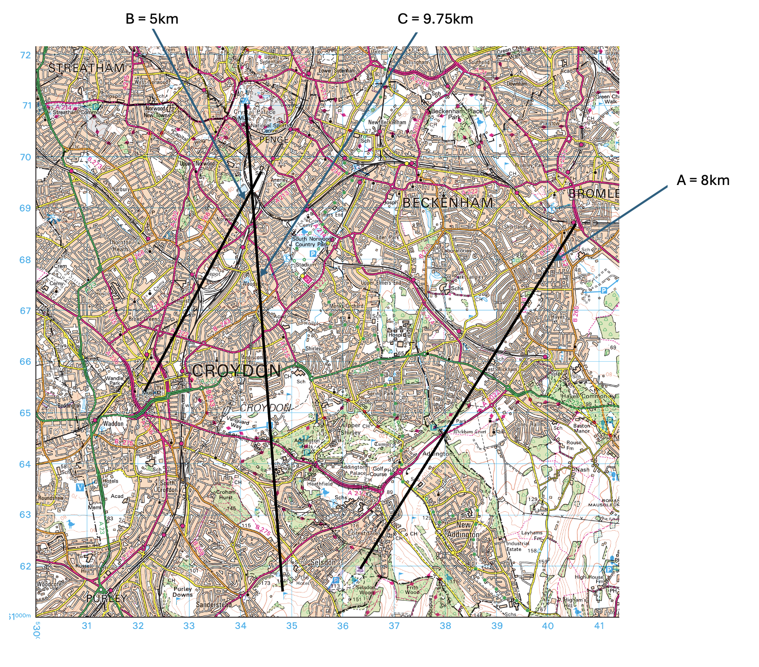
Study the Ordnance Survey map extract (Item B) (opens in a new tab) of the Croydon area.
Measure the three distances (A, B and C) between the places shown in the table.
Match your answers for A, B and C with the distances given below.
A From the train station (4068) to the National Trust (3661)
B From the school (3469) to the museum (3265)
C From the camping and caravan site (3471) to the golf course (3461)
Choose from the following distances:
5 km 9.75 km 8 km 6.25 km
Answer

Unlock more, it's free!
Join the 100,000+ Students that ❤️ Save My Exams
the (exam) results speak for themselves:

Was this revision note helpful?