Glaciated Landscapes: Processes (SQA National 5 Geography): Revision Note
Exam code: X833 75

Specification checklist
This page covers what you need to know from the SQA National 5 geography specification to answer questions on:
Landscape types
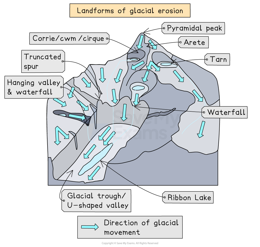
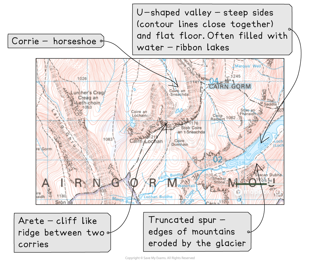
Glaciated upland - corrie, truncated spur, pyramidal peak, arête, u-shaped valley
The processes of glaciation
Glaciers create distinct landforms through weathering, erosion, transportation and deposition
Freeze-thaw weathering
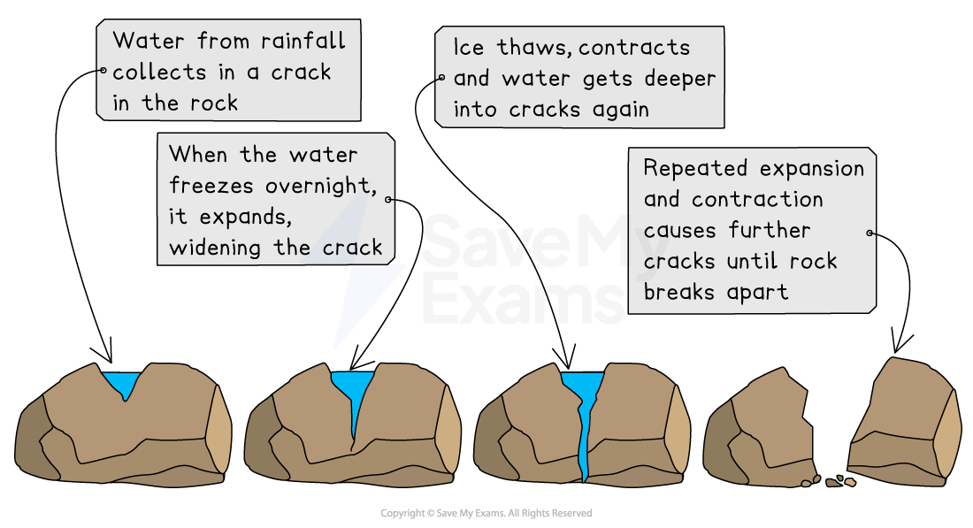
Freeze-thaw weathering happens when rocks contain cracks and temperatures regularly dip below the freezing point
Water enters cracks or joints in rock.
When the temperature drops below 0°C, the water in the crack freezes and expands, making the crack larger
This process is repeated through continual thawing and freezing, so the crack/joint gets larger over time
Eventually, pieces of rock break off
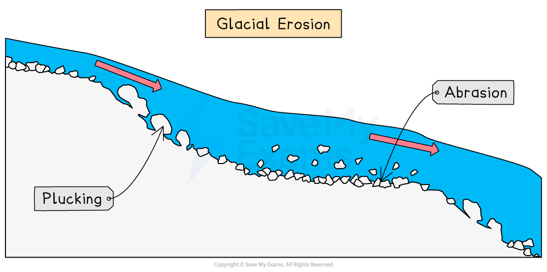
Plucking
As a glacier moves, pressure is exerted on the sides and bottom of the valley
This generates friction and heat, causing the edges of the glacier to melt a little
The water then freezes onto solid rock
As the glacier/ice moves away, it pulls large pieces of rock with it, eroding the landscape
Abrasion
Rock fragments carried by the glacier wear away the sides and floor of the valley (the sandpaper effect)
Examiner Tips and Tricks
Do remember that the process of freeze-thaw is a cycle and happens over a long time.
Practice using a sketch to help you remember the process.
Formation of glacial landscape features
Examiner Tips and Tricks
For the exam, you need to know the processes which lead to the formation of corries, truncated spurs, pyramidal peaks, arêtes and U-shaped valleys.
You also need to be able to identify these features on an OS map or photograph. You can see an example of this in the geographical skills section.
Formation of a corrie
Snow accumulates in north-facing hollows and compresses into neve, then glacial ice
As a glacier moves downhill under the force of gravity
Plucking steepens the back wall
Abrasion deepens the hollow
When the ice melts, a horseshoe-shaped hollow is left, often with a rock lip trapping glacial meltwater to form a tarn
Examples include: Corrie Cas in the Cairngorms or Red Tarn in the Lake District
Formation of an arête
When two corries erode back to back or side by side, a steep, knife-edged ridge called an arête is formed
E.g. Striding Edge on Helvellyn in the Lake District is formed
Formation of a pyramidal peak
When three or more corries erode back to back, a pyramidal peak is formed.
Eg: The Matterhorn
Formation of a U-shaped Valley
Gravity causes glaciers to flow downhill
They follow existing V-shaped valleys with interlocking spurs
Erosion through plucking and abrasion takes place
Plucking and abrasion lead to the valley becoming deeper, wider and straighter, with a flat valley floor, in the shape of a U
Misfit streams often flow in U-shaped valleys
These are streams which no longer fit the valley floor and are too small to have eroded the valley in which they flow
Glencoe is an example of a U-shaped valley
Formation of a truncated spur
During the formation of a U-shaped valley, the ends of interlocking spurs are eroded by the glacier, leaving truncated spurs and steep valley sides
When the ice melts, the valley is a U shape with steep sides, which are the truncated spurs
Worked Example
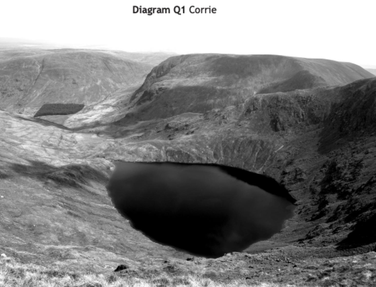
Look at Diagram Q1
Explain the formation of a corrie.
You may use a diagram(s) in your answer.
[4 marks]
During the ice age, snow collected in north-facing hollows on a mountain [1]
The snow compressed to neve, then to ice and formed glaciers, which moved downhill due to gravity [1]
Abrasion deepens the hollow and Plucking steepens the back wall [1]
After glaciation, an armchair-shaped hollow remains, which may fill with meltwater to create a tarn [1]

Unlock more, it's free!
Join the 100,000+ Students that ❤️ Save My Exams
the (exam) results speak for themselves:

Was this revision note helpful?
