Navigation Courses (SQA National 5 Applications of Mathematics): Revision Note
Exam code: X844 75

Navigation courses
What is a navigation course?
A navigation course is a journey starting at one destination and ending on another
Questions involve scale drawings and bearings
Examiner Tips and Tricks
Most exam questions involve two journeys. The question will give you space to draw your navigation course, with the starting point with a north line drawn ready for you.
How do I draw a navigation course?
First journey
Convert the actual distance of the first journey into a distance to draw using the scale
Measure the given bearing starting from the starting destination
Measure from the north line
Measure the distance in that direction
Put a cross and label that destination
Second journey
Draw a north line at the current destination
Repeat the steps above for the second journey
Draw a straight line from the starting destination to the final destination
You can use this to find:
the distance between them
the bearing from the starting destination to the final destination
Worked Example
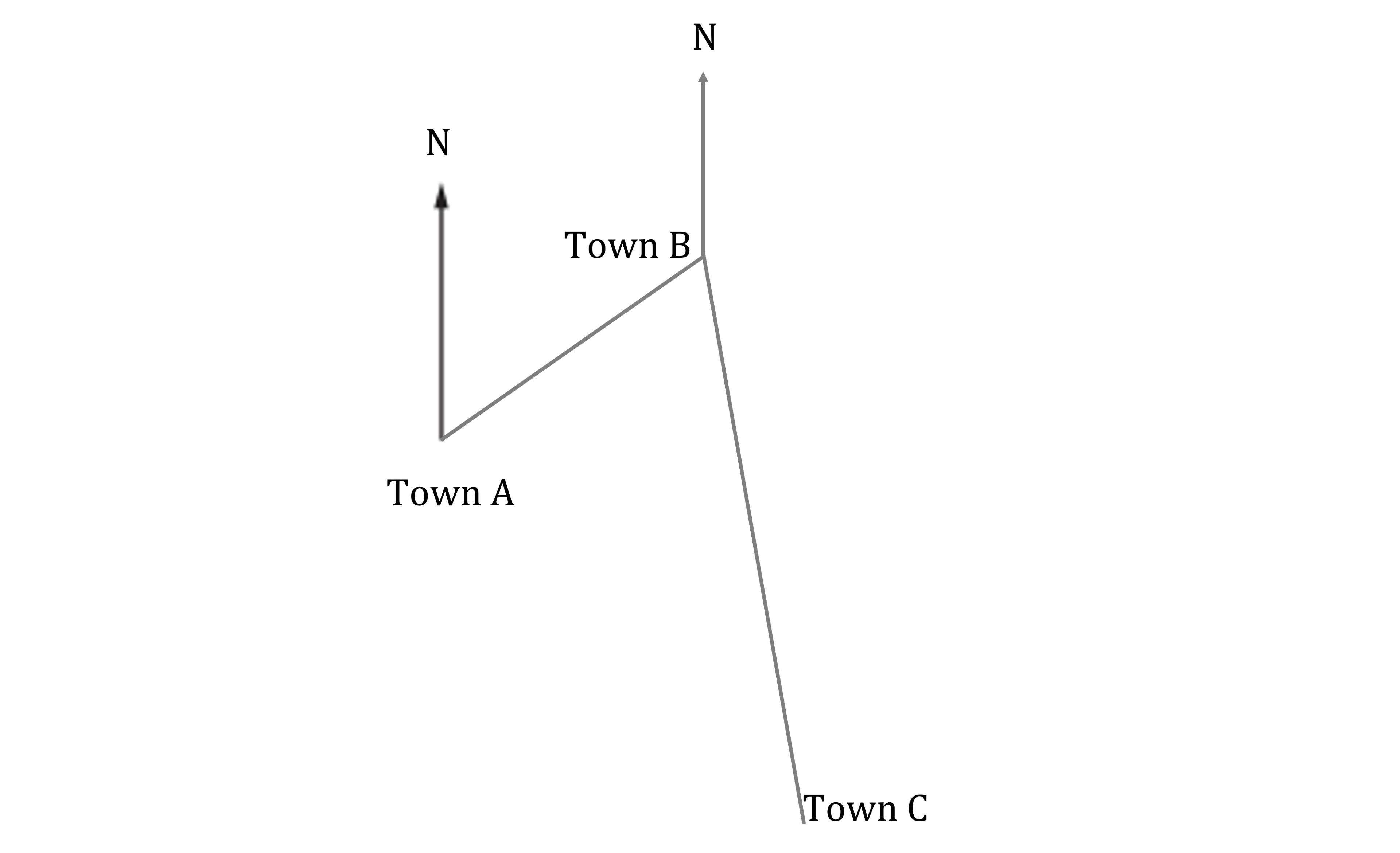
Julie is travelling between three towns.
Julie leaves Town A and travels on a bearing of 055° for 17.5 km to Town B.
Julie then travels on a bearing of 170° for 31.5 km to Town C.
(a) Construct a scale drawing to illustrate the route.
Use a scale of 1 cm : 5 km

(b) Julie then returns to Town A.
Use the scale drawing to determine the bearing and distance of Town A from Town C.
Answer:
(a)
Use the scale to find the scaled lengths for 17.5 km and 31.5 km
![]()
![]()
Draw a 3.5 cm line on a bearing of 055° from Town A and label it as "Town B"

Draw a 6.3 cm line on a bearing of 170° from Town B and label it as "Town C"
(b)
Join Town C to Town A with a straight line

Measure the line and multiply by 5 to find the actual distance
![]()
Measure the bearing from Town C to Town A
29 km on bearing 317°

Unlock more, it's free!
Join the 100,000+ Students that ❤️ Save My Exams
the (exam) results speak for themselves:

Was this revision note helpful?