1
3 marks
Explain why the building of large settlements on or close to a flood plain increases the discharge of a river after heavy rain.
Was this exam question helpful?
Syllabus Edition
First teaching 2025
First exams 2027
Exam code: 0460 & 0976
Explain why the building of large settlements on or close to a flood plain increases the discharge of a river after heavy rain.
Was this exam question helpful?
Study Figs. 1.1, 1.2 and 1.3, which are photographs of three different rivers.

Fig 1.1

Fig 1.2

Fig 1.3
Using evidence from Figs. 1.1, 1.2, and 1.3 only, describe three different benefits of living near a river
Was this exam question helpful?
Study Fig. 4.1, which is information about flooding which was predicted for the area around the Mississippi River, USA, in December 2015.

Suggest two reasons why most of the major flooding predicted was at Cape Girardeau.
Describe three likely impacts of flooding in the rural areas between St Louis and Cape Girardeau.
Was this exam question helpful?
Study Fig. 4.2, which is information about river flooding in Spain.
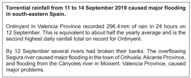
Suggest three different problems which may have been caused by the river flooding in towns such as Orihuela and Moixent.
Was this exam question helpful?
Study Fig. 1.1, which shows river pollution in the River Thames, England.
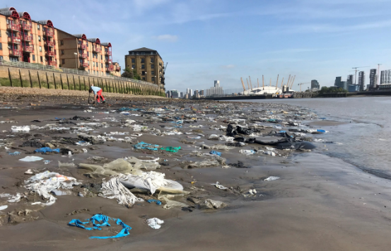
Fig. 1.1
Suggest three different problems which may have been caused by the river pollution in areas such as London.
Was this exam question helpful?
Describe the human causes of flooding.
Was this exam question helpful?
Describe the methods used to manage the impacts of river flooding.
Was this exam question helpful?
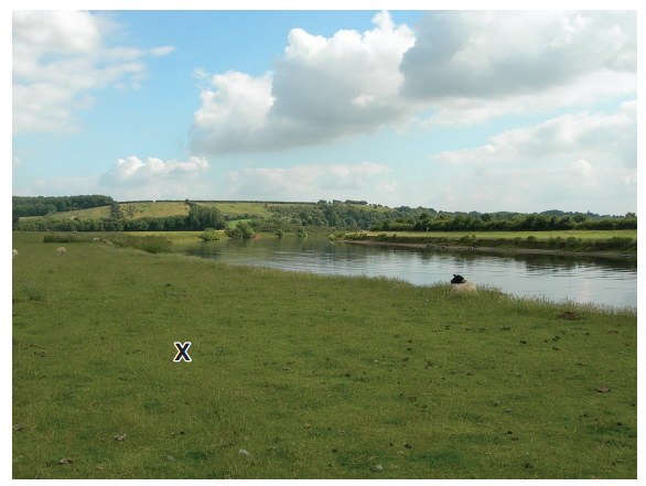
Give two advantages and two disadvantages of living close to a river such as the one shown in Fig. 1.
Was this exam question helpful?
Study Figs. 3.2, 3.3 and 3.4, which are photographs of three different rivers.
Fig 3.2
Fig 3.3
Fig 3.4
Explain why living on a delta or near a river may be hazardous for people.
Was this exam question helpful?
State two different methods to reduce river flooding. For each method explain how it works.
Method 1 .........................................................................................
Explanation ....................................................................................
Method 2 ........................................................................................
Explanation .....................................................................................
Was this exam question helpful?
Study Fig. 4.3, which is a map of an area in Asia where river flooding occurred.

Fig. 4.3
Suggest reasons why the rivers flooded in the areas shown in Fig. 4.3.
Suggest the methods which could be used in the area shown in Fig. 4.3 to prevent flooding.
Was this exam question helpful?
For a named river you have studied, explain how flooding is being managed
Was this exam question helpful?
Describe the hazards provided by a named river you have studied for people who live close to it
Named river ..............
Was this exam question helpful?
For a named river you have studied, explain the causes of flooding.
Name of river ..............................
Was this exam question helpful?
For a named river you have studied, explain the causes of pollution.
Name of river ..............................
Was this exam question helpful?
For a named river you have studied, describe how pollution is being managed
Was this exam question helpful?