1
3 marks
Study Fig. 3.1, which shows a river drainage basin.
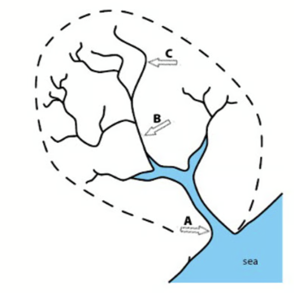
Using Fig. 3.1, identify the following the river features A, B and C.
Was this exam question helpful?
Syllabus Edition
First teaching 2025
First exams 2027
Exam code: 0460 & 0976
Study Fig. 3.1, which shows a river drainage basin.
Using Fig. 3.1, identify the following the river features A, B and C.
Was this exam question helpful?
Study Fig. 3.1, which shows information about flows through a drainage basin.
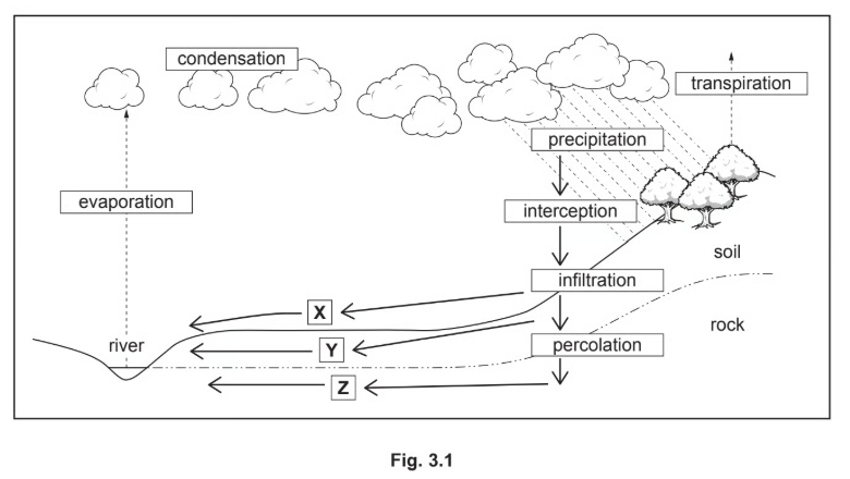
What is meant by transpiration?
Identify the processes which take place at X,Y and Z in Fig 3.1.
Explain why the amount of interception varies:
From place to place.
At different times of the year.
Was this exam question helpful?
Study Figs. 1.1 and 1.2 which are photographs showing two different rivers and their valleys.

Fig 1.1

Fig 1.2
Describe the similarities and differences between the rivers shown in Figs. 1.1 and 1.2.
Was this exam question helpful?
Study Fig. 3, which is a flow diagram showing processes in a drainage basin.
Fig.3
What is a drainage basin?
Suggest three reasons why overland flow may occur in a drainage basin.
Was this exam question helpful?
Study Fig. 4, which is a photograph of part of a river.
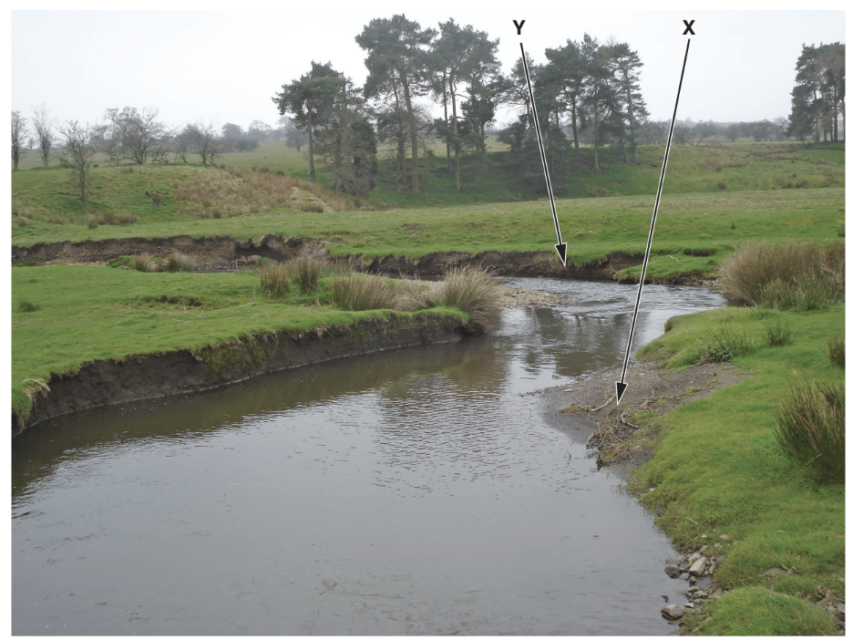
Fig 4
What river feature is shown in Fig. 4?
Underline one answer in the list below:
confluence meander potholes source
Describe two characteristics of the feature labelled X on Fig. 4.
Was this exam question helpful?
Study Fig. 5.1, which shows a map of an upland area, and Fig. 5.2, which is a photograph of a waterfall.

Fig. 5.1

Fig. 5.2
Which location A, B, C or D is the most likely position of the waterfall shown in Fig. 5.2?
Identify features X and Y in Fig 5.2.
Explain why a gorge may form downstream of a waterfall.
Was this exam question helpful?
Which river feature is shown in Fig 7.1?
confluence oxbow lake potholes source
What evidence from Fig. 7.1 suggests that:
the river is carrying a large load in suspension?
deposition is taking place?
Another area where a river deposits its load is on its delta. Explain why deposition takes place on a delta.
Was this exam question helpful?
Table 6.1 gives the definitions of some terms used in the study of rivers and drainage basins.
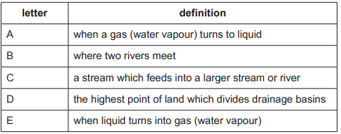
For each of the following terms give the letter for the correct definition from Table 6.1:
Was this exam question helpful?
Explain how the landform labelled X in Fig. 7.1 was formed.
Was this exam question helpful?
Suggest reasons why the amount of infiltration may vary .
Was this exam question helpful?
Describe the changes in the characteristics of a river from its source to its mouth using the following headings:
width .........................................................................
depth.........................................................................
speed of flow.............................................................
gradient.....................................................................
Was this exam question helpful?
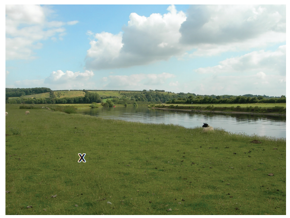
Study Fig. 3.1, which shows different parts of a river and its valley.

Explain why deposition is likely to take place in the area shown in A in Fig. 3.1.
Was this exam question helpful?
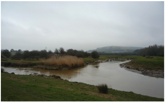
Study Fig. 4.1, which is a photograph of part of a river.

Figure 4.1
Suggest how the course of the river shown in Fig. 4.1 may change in the future as a result of natural processes
Was this exam question helpful?
Explain how rivers erode their valleys.
Was this exam question helpful?
Explain how a delta is formed.
Was this exam question helpful?
Describe the changes which occur along a river and its valley from its source to its mouth. You should refer to processes and landforms.
Was this exam question helpful?
Explain the river processes involved in the formation of a waterfall.
Was this exam question helpful?
Explain the river processes involved in the formation of a meander.
Was this exam question helpful?
Study Fig. 1.1 and explain the river processes involved in the formation of the landform shown at X.

Was this exam question helpful?
Explain the importance of both erosion and deposition in the formation of oxbow lakes.
Was this exam question helpful?