1
1 mark
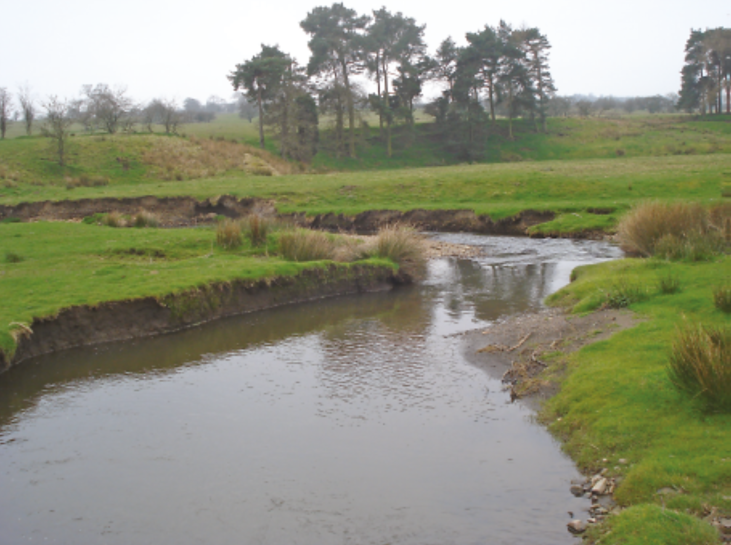
What river feature is shown in Fig. 4.1?
Confluence
Meander
Oxbow lake
Source
Was this exam question helpful?
Exam code: 0460 & 0976
Syllabus Edition
First teaching 2025
First exams 2027
What river feature is shown in Fig. 4.1?
Confluence
Meander
Oxbow lake
Source
Was this exam question helpful?
Study Figs. 6.2, 6.3 and 6.4, which are photographs of economic activities that increase greenhouse gases in the atmosphere.
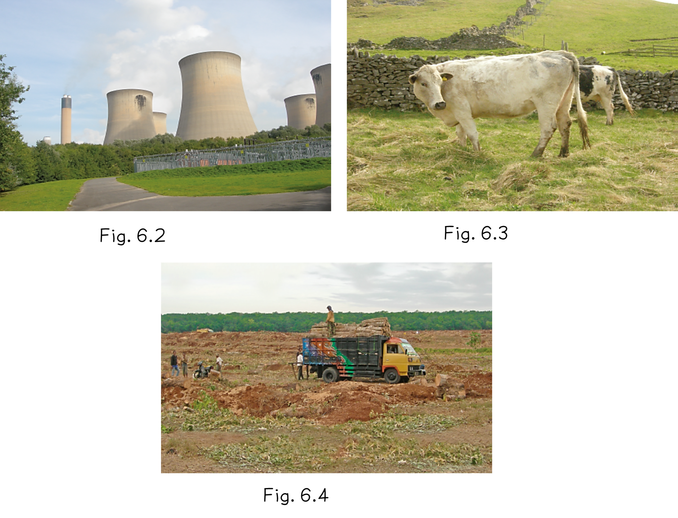
Explain how each of the economic activities shown in Figs. 6.2, 6.3 and 6.4 increases greenhouse gases in the atmosphere.
Was this exam question helpful?
Study Fig. 4.2, which shows an area of Brazil that has been partially deforested.
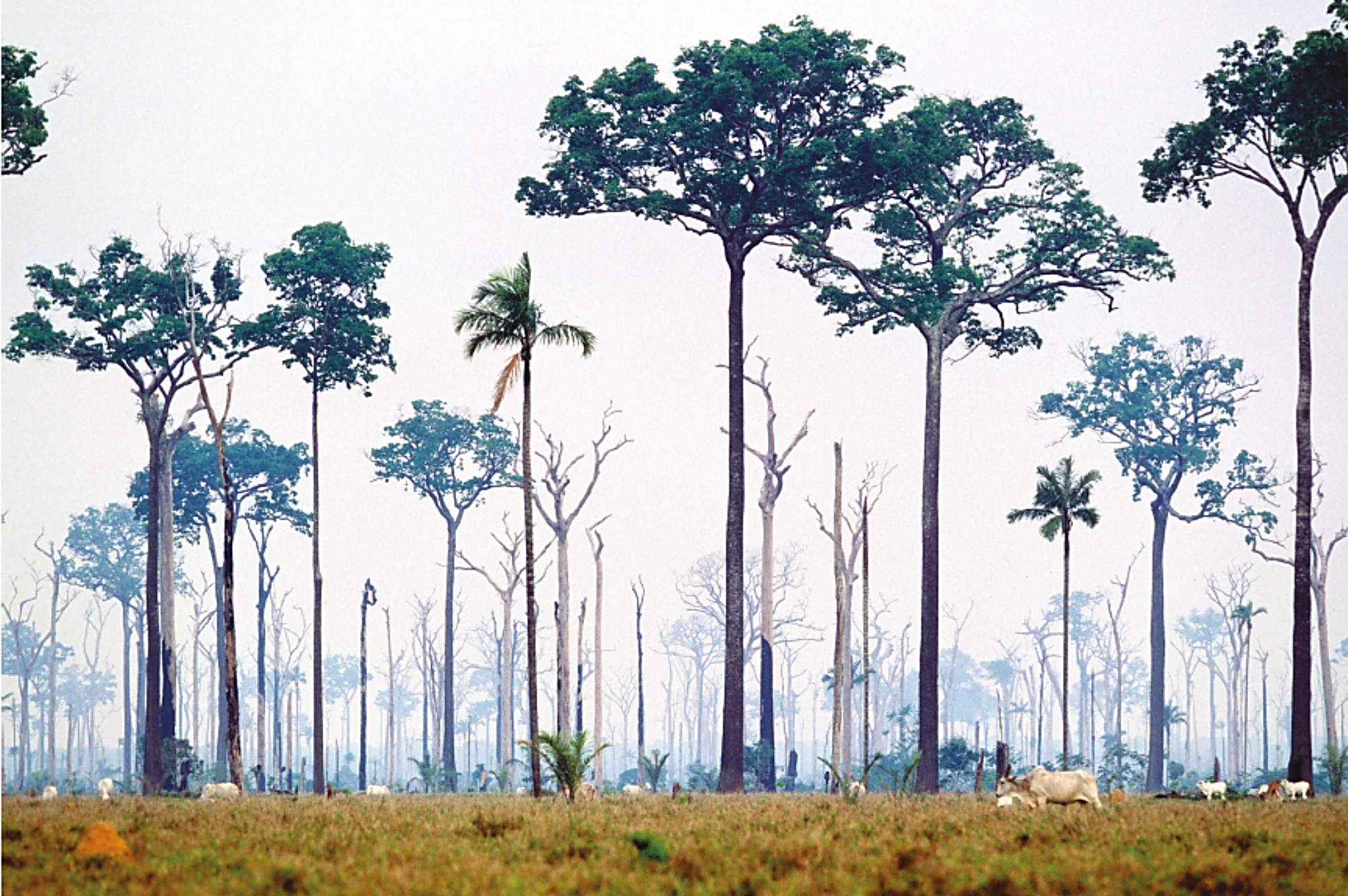
Identify the type of farming shown in Fig. 4.2.
Was this exam question helpful?
A flood risk map shows red zones near rivers and green zones on higher land. Which zone is safer for a hospital and why?
Was this exam question helpful?
Study Fig. 4.2, which shows an area of Brazil that has been partially deforested.
Describe the vegetation shown in Fig. 4.2.
Was this exam question helpful?
Explain how GIS can help decision-makers reduce the impacts of flooding.
Was this exam question helpful?
Study the photograph of a coastal landscape.
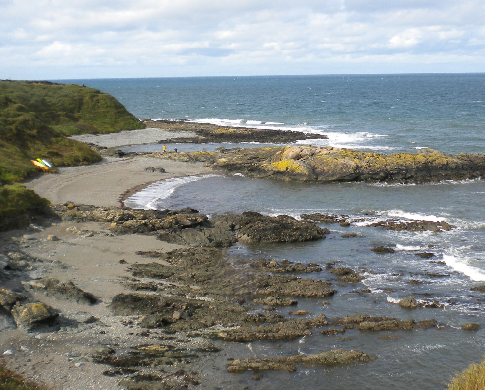
Identify the main process and its features that helped shape the coastline.
Was this exam question helpful?