Syllabus Edition

First teaching 2025

First exams 2027

Coastal Processes & Landforms (Cambridge (CIE) IGCSE Geography): Exam Questions

Exam code: 0460 & 0976

1 hour18 questions
1a1 mark

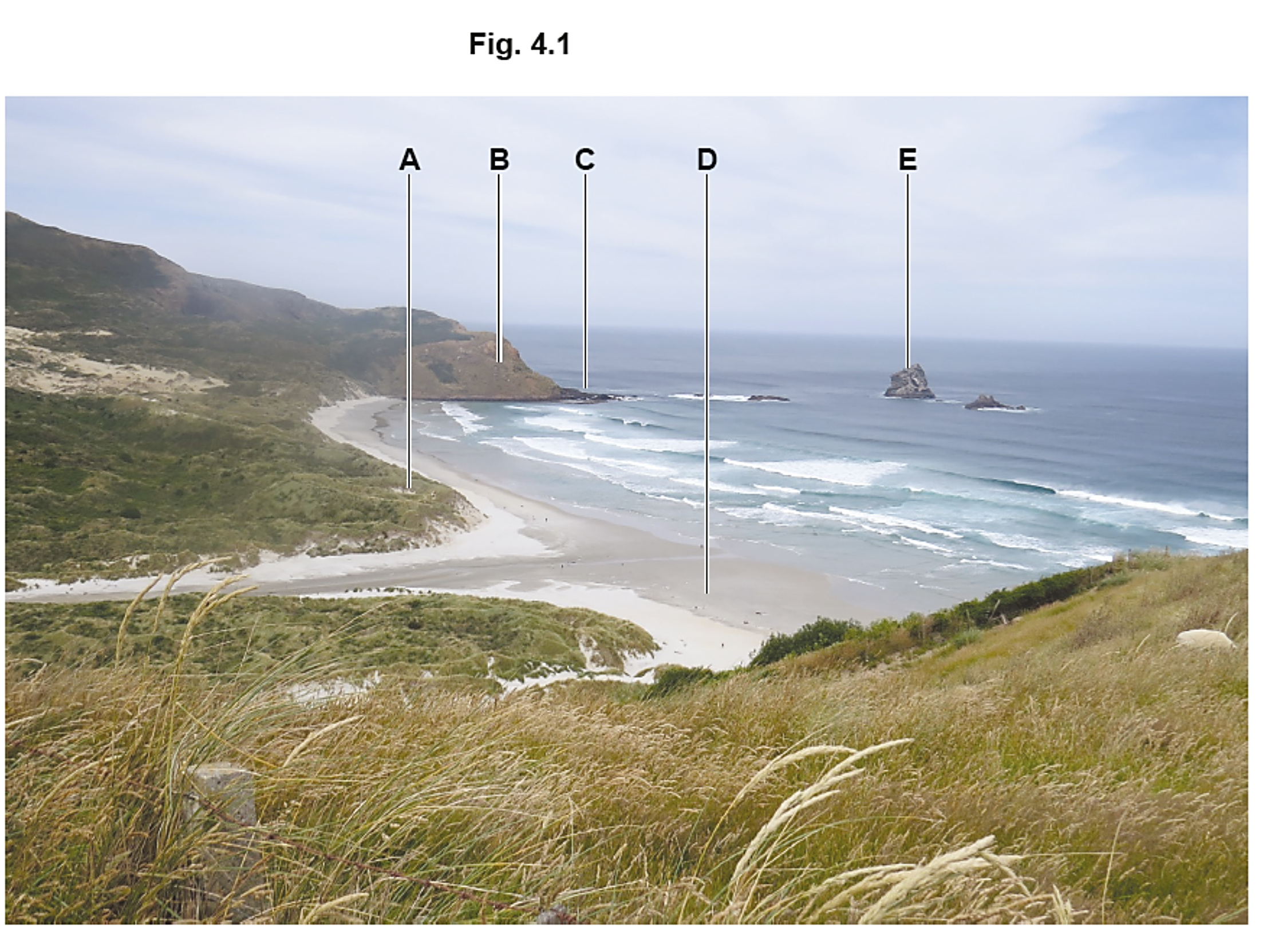
Study Figure 2.1, a photograph showing a bay at low tide.

Rocky coastal bay with sandy beach and green cliffs, waves lapping against rocks, and small boats on the shore under a cloudy sky.

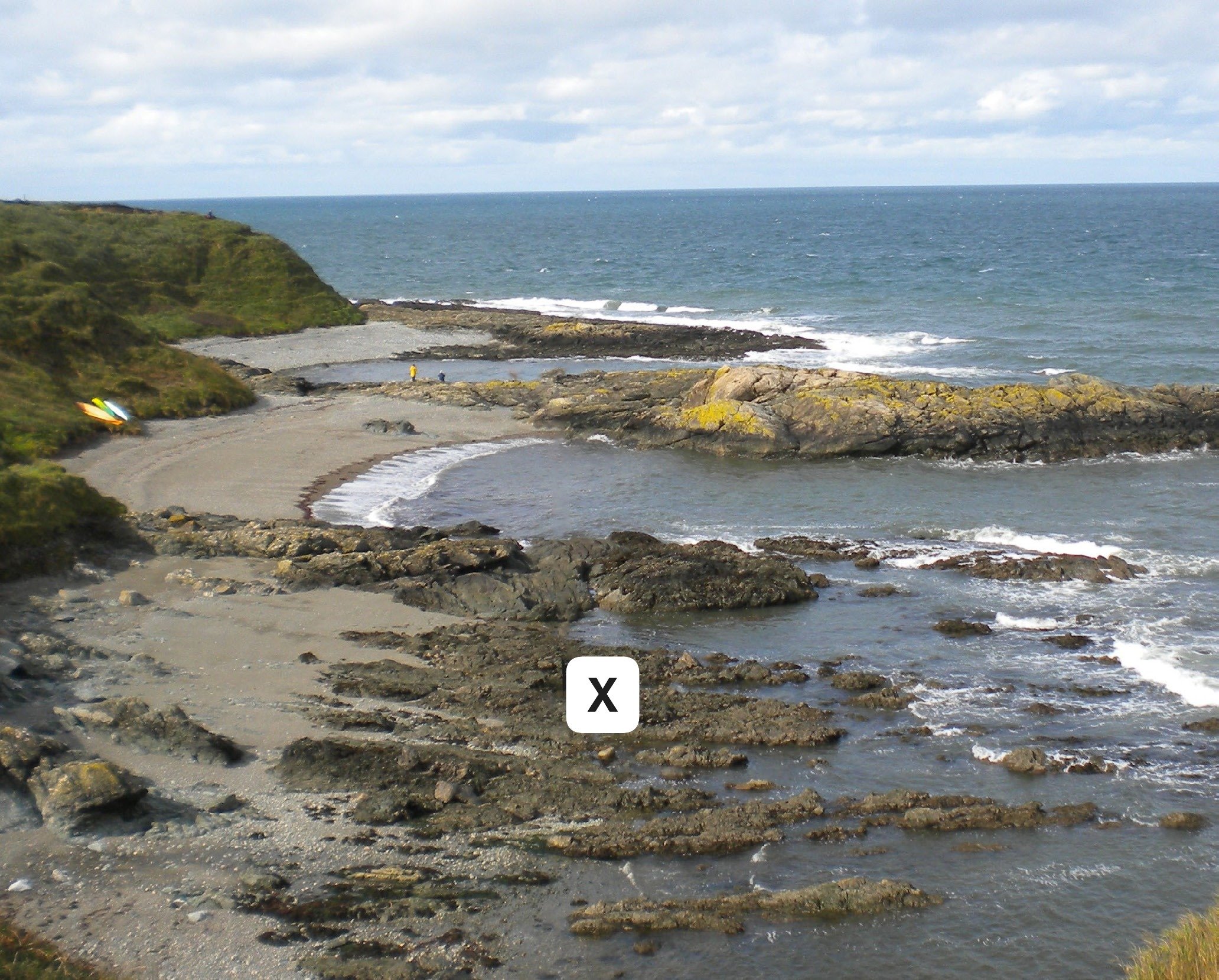
Name the coastal landform labelled X in Figure 2.1.

1b2 marks

Use Figure 2.1 to identify two characteristics of the landform labelled X.

1c3 marks

Use Figure 2.1 to describe the features of the bay. Do not refer to landform X.

2a1 mark

Fig. 4.1 shows a coastal area in New Zealand. Identify features A–E shown in Fig. 4.1.

Coastal landscape with grassy dunes in foreground, sandy beach, rocky headlands labelled A-E, and ocean with waves under a lightly cloudy sky.

Identify feature A.

  • sand dune

  • beach

  • cave

  • headland

2b1 mark

Identify feature B in Fig. 4.1 that shows a coastal area in New Zealand.

  • sand dune

  • spit

  • cave

  • headland

2c1 mark

Identify feature C in Fig. 4.1 that shows a coastal area in New Zealand.

  • spit

  • stack

  • wave-cut platform

  • arch

2d1 mark

Identify feature D in Fig. 4.1 that shows a coastal area in New Zealand.

  • beach

  • headland

  • spit

  • wave-cut platform

2e1 mark

Identify feature E in Fig. 4.1 that shows a coastal area in New Zealand.

  • spit

  • stack

  • sand dune

  • arch

32 marks

State two types of coastal erosion.

41 mark

What is meant by longshore drift?

51 mark

Identify one characteristic of constructive waves.

63 marks

Describe how a spit forms.

72 marks

Give two reasons why destructive waves erode coastlines.

14 marks

Explain why bays and headlands form along discordant coastlines.

24 marks

Explain the difference between constructive and destructive waves.

35 marks

Describe how a wave-cut platform forms.

44 marks

Explain how geological structure influences coastal landforms.

55 marks

Explain how a spit forms.

64 marks

Explain how longshore drift affects the formation of coastal landforms.

17 marks

Explain how caves, arches, stacks, and stumps are formed.

27 marks

Explain how a sand dune system forms and changes over time.

37 marks

Explain how wave refraction affects coastal erosion and deposition.

47 marks

Study Figs. 4.2, 4.3 and 4.4, which are photographs that show different features formed on a headland. 

Rocky coastal cave with a pointed arrow marking the entrance. Sandy beach with scattered rocks and footprints; a person in the distance near the shore.

Fig. 4.2

A rocky sea arch rising from the water, indicated by an arrow, against a calm sea and clear sky backdrop.

Fig. 4.3

Tall rock formation in the sea reflecting on calm water with an arrow pointing to its midsection under a clear sky; some rocks visible in the foreground.

Fig. 4.4

Describe how the features shown in Figs. 4.2, 4.3 and 4.4 were formed on a headland.

57 marks

Explain how coastal processes lead to the formation of headlands and bays.