12 marks
Give two ways of preventing or reducing soil erosion.
Was this exam question helpful?
Exam code: 0460 & 0976
Syllabus Edition
First teaching 2018
Last exams 2026
Give two ways of preventing or reducing soil erosion.
Was this exam question helpful?
Fig. 6.1 shows areas in Africa at risk of desertification. Desertification is when land can no longer support vegetation and agriculture becomes unproductive.

Using Fig. 6.1, describe the distribution of areas in Africa at risk of desertification.
Was this exam question helpful?
Fig. 6.1 shows areas in Africa at risk of desertification. Desertification is when land can no longer support vegetation and agriculture becomes unproductive.
Using Fig. 6.2, explain how rainfall could be one factor which could lead to desertification.
Was this exam question helpful?
Table 3.1 shows information about the top 7 most polluted cities in the world.
City | Lahore. Pakistan | New Delhi, India | Dhaka, Bangladesh | Peshawar, Pakistan | Ghaziabad, India | Patna, India |
|---|---|---|---|---|---|---|
Level of PM 2.5 | 150.4 | 78.7 | 72.9 | 70.9 | 53.4 | 51.3 |
Describe the information in the table. Include statistics in your answer.
Figure 3.1 shows a poster promoting Birmingham’s Clean Air Zone.
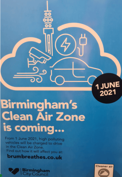
With reference to Figure 3.1, explain how a clean air zone will decrease air pollution.
Suggest two reasons why some people may be against the Clean Air Zone.
Was this exam question helpful?
Study Fig. 6.2, which shows information about desertification in Northern Africa.

Fig. 6.2
Describe the impacts of desertification on local people.
Was this exam question helpful?