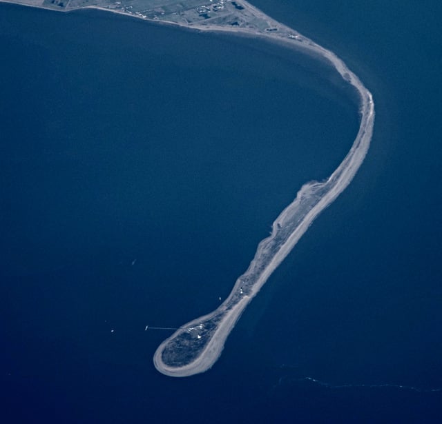
1
6 marks
Study Figure 3b

Figure 3b
A depositional landscape in North Wales
Explain the role of sediment transport in the development of this coastal landscape.
Was this exam question helpful?
Exam code: 9GE0
Study Figure 3b
Figure 3b
A depositional landscape in North Wales
Explain the role of sediment transport in the development of this coastal landscape.
Was this exam question helpful?
Study Figure 3a

Figure 3a
A coastal landscape
Explain the contribution of marine erosional processes to the development of this landscape.
Was this exam question helpful?
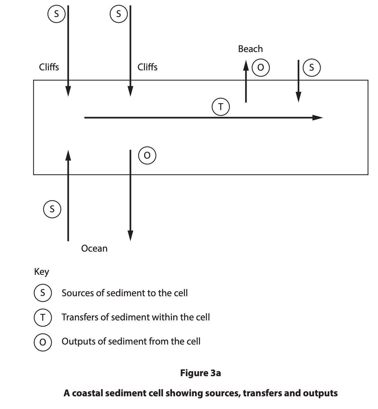
Explain how the sediment cell concept contributes to the understanding of coastal systems.
Was this exam question helpful?
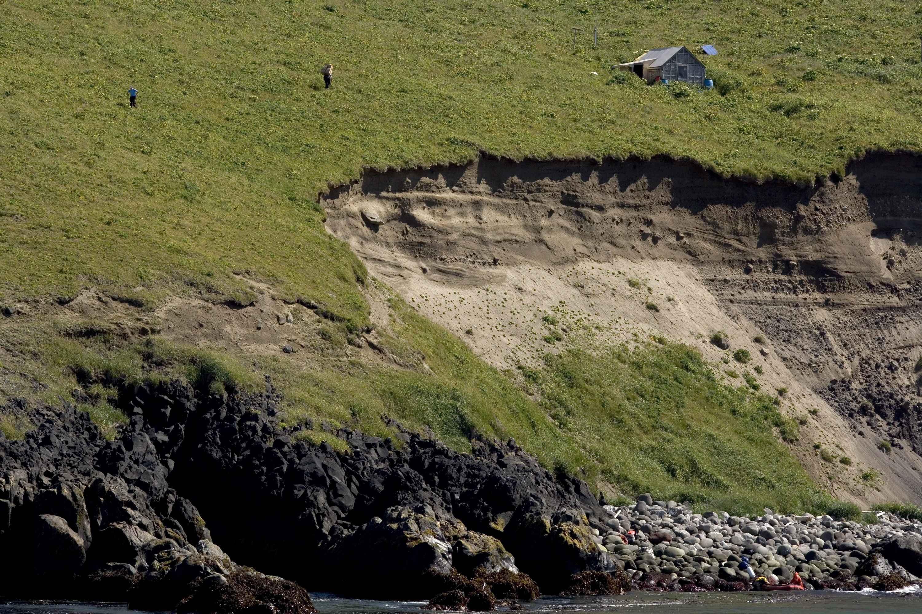
Study Figure 3b in the Resource Booklet.

Figure 3b
A coastal plain landscape
Explain the contribution of coastal deposition to the development of this landscape.
Was this exam question helpful?
Study Figure 3b.
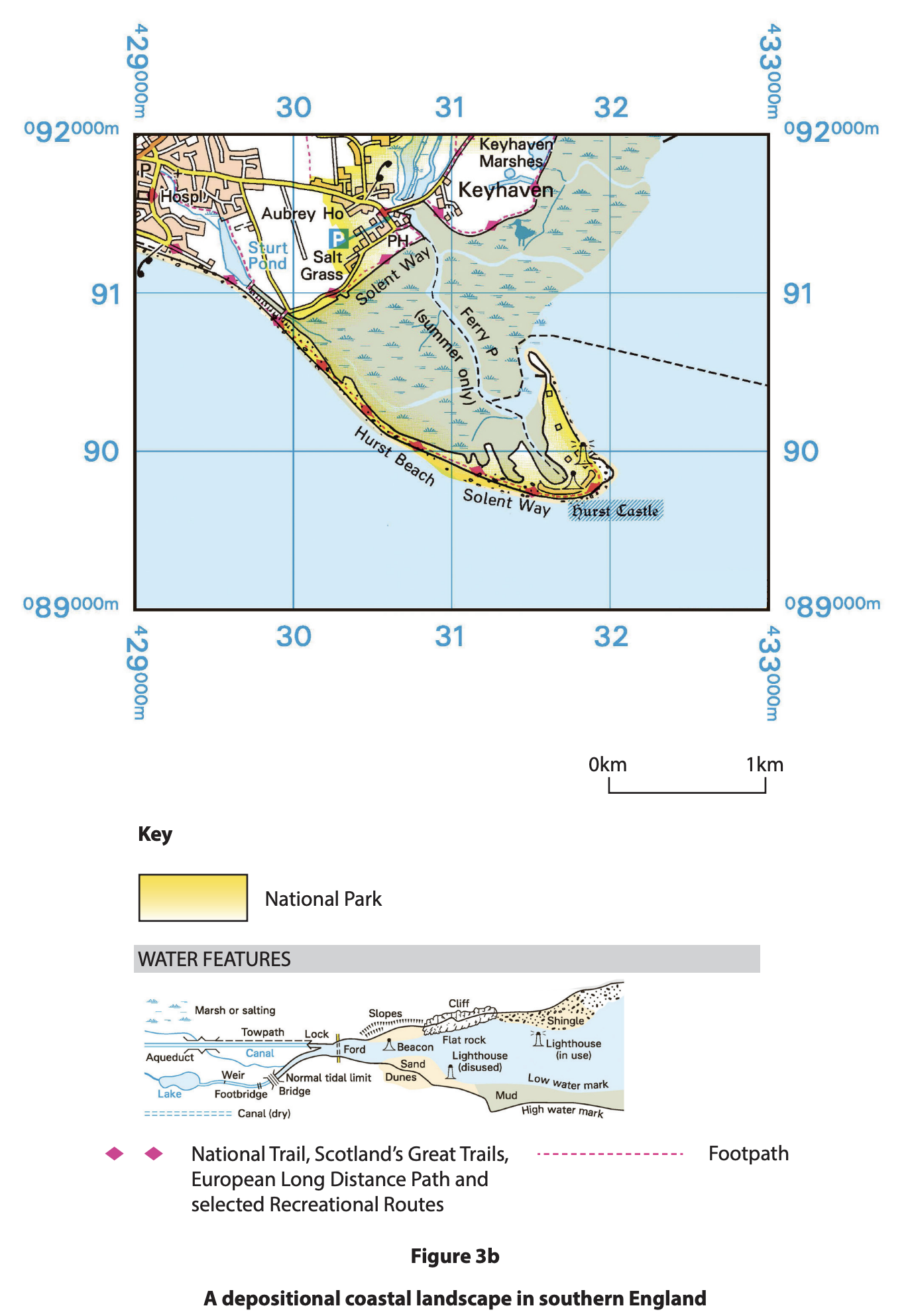
Explain how sediment transport and deposition contribute to the formation of this landscape.
Was this exam question helpful?
Explain the role of mass movement in creating distinctive coastal landforms.
Was this exam question helpful?
Study Figure 3a.
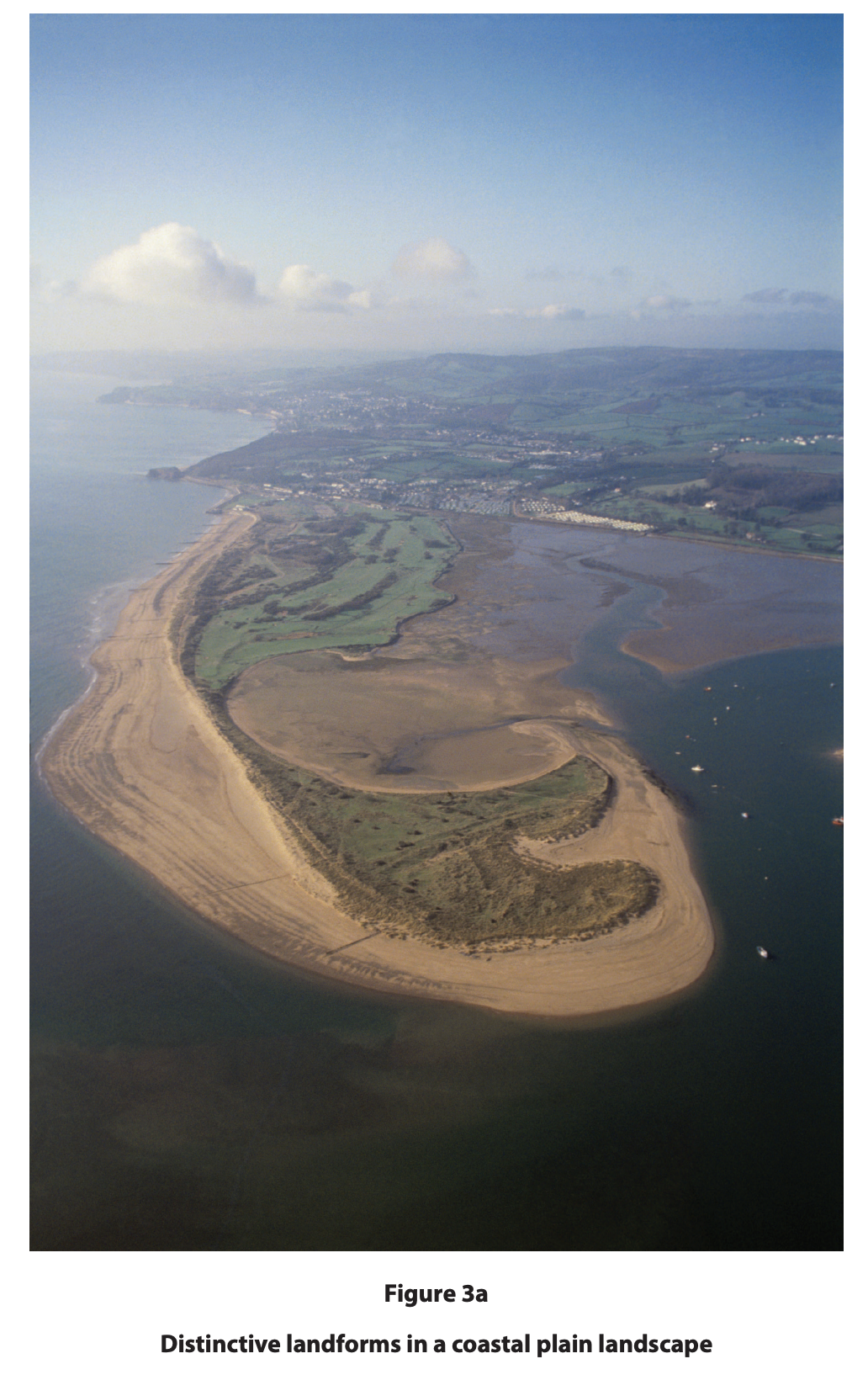
Explain the contribution of marine processes in the development of these landforms.
Was this exam question helpful?
Study Figure 3b.
Explain how subaerial processes contribute to the development of this landscape.
Was this exam question helpful?
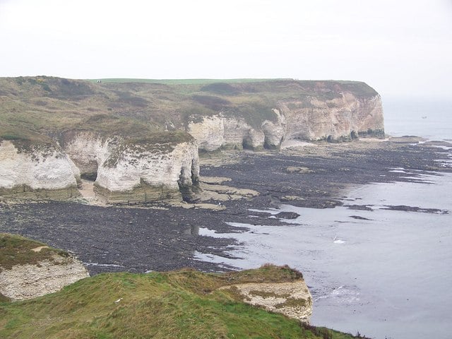
Study Figure 3a.
Explain the contribution of erosional processes in producing sediment.
Was this exam question helpful?
Study Figure 1.
Explain how marine erosion processes contribute to the formation of the landform shown.
Was this exam question helpful?
Study Figure 1.
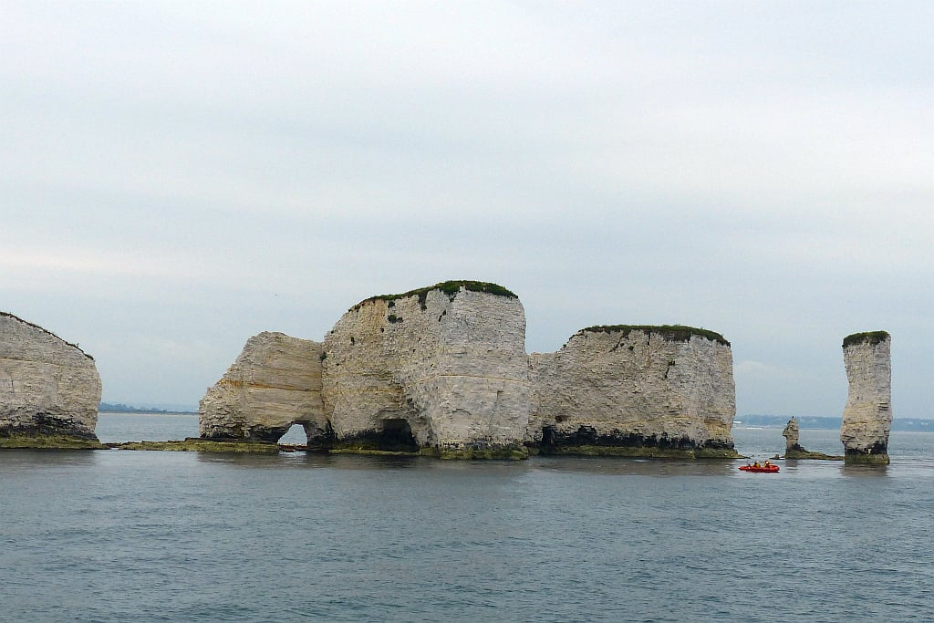
Explain how erosion has produced the landforms shown at this headland.
Was this exam question helpful?
Study Figure 1.
Explain how longshore drift contributes to the formation of the landform shown.
Was this exam question helpful?
Study Figure 1.
Explain how subaerial processes contribute to the development of the cliff shown.
Was this exam question helpful?
Study Figure 1.
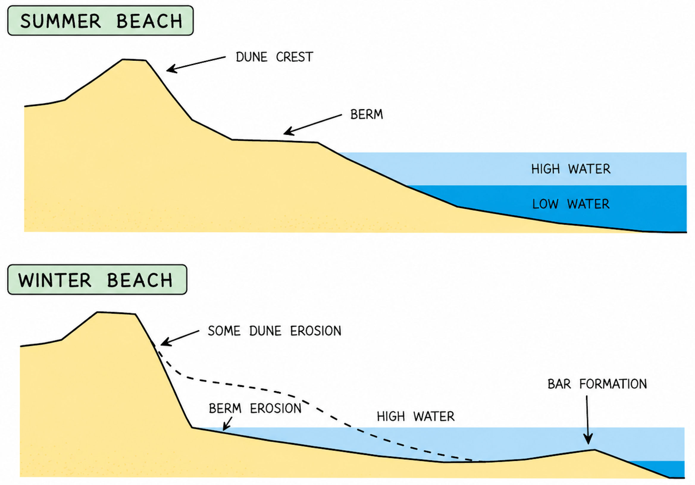
Explain how wave type affects the beach profiles shown.
Was this exam question helpful?
Evaluate the view that marine processes are more important than subaerial processes in shaping coastal landscapes.
Was this exam question helpful?
Evaluate the view that coastal landscapes are shaped more by erosion than by deposition.
Was this exam question helpful?
Evaluate the view that a coastline is best understood as a system in a state of dynamic equilibrium.
Was this exam question helpful?