16 marks
Study Figure 2b

Figure 2b
Pro-glacial deposits at the snout of the Spielboden Glacier
Explain the differences in the characteristics of the deposits at locations A and B.
Was this exam question helpful?
Exam code: 9GE0
Study Figure 2b
Figure 2b
Pro-glacial deposits at the snout of the Spielboden Glacier
Explain the differences in the characteristics of the deposits at locations A and B.
Was this exam question helpful?
Explain how upland glacial landforms can be used to study former ice extent and movement.
Was this exam question helpful?
Study Figure 2a

Figure 2a
A relict glaciated landscape
Explain the contribution of glacial erosional processes to the development of this landscape
Was this exam question helpful?
Explain the role of glacial meltwater in creating distinctive landforms.
Was this exam question helpful?
Figure 2 shows a lowland glaciated landscape during and after glaciation.

Figure 2A A glaciated lowland during the Ice Age
Study Figure 2A.
Explain how meltwater has contributed to the formation of the proglacial features shown.
Was this exam question helpful?
Study Figure 3.
Figure 3
A relict glaciated valley landscape
Explain the contribution of glacial deposition to the development of this landscape.
Was this exam question helpful?
Study Figure 4
Figure 4 shows a lowland glaciated landscape during and after glaciation.

Figure 4 A glaciated lowland after the Ice Age
Explain how the landforms shown in Figure 2B can be used to help reconstruct ice movement.
Was this exam question helpful?
Study Figure 2a.
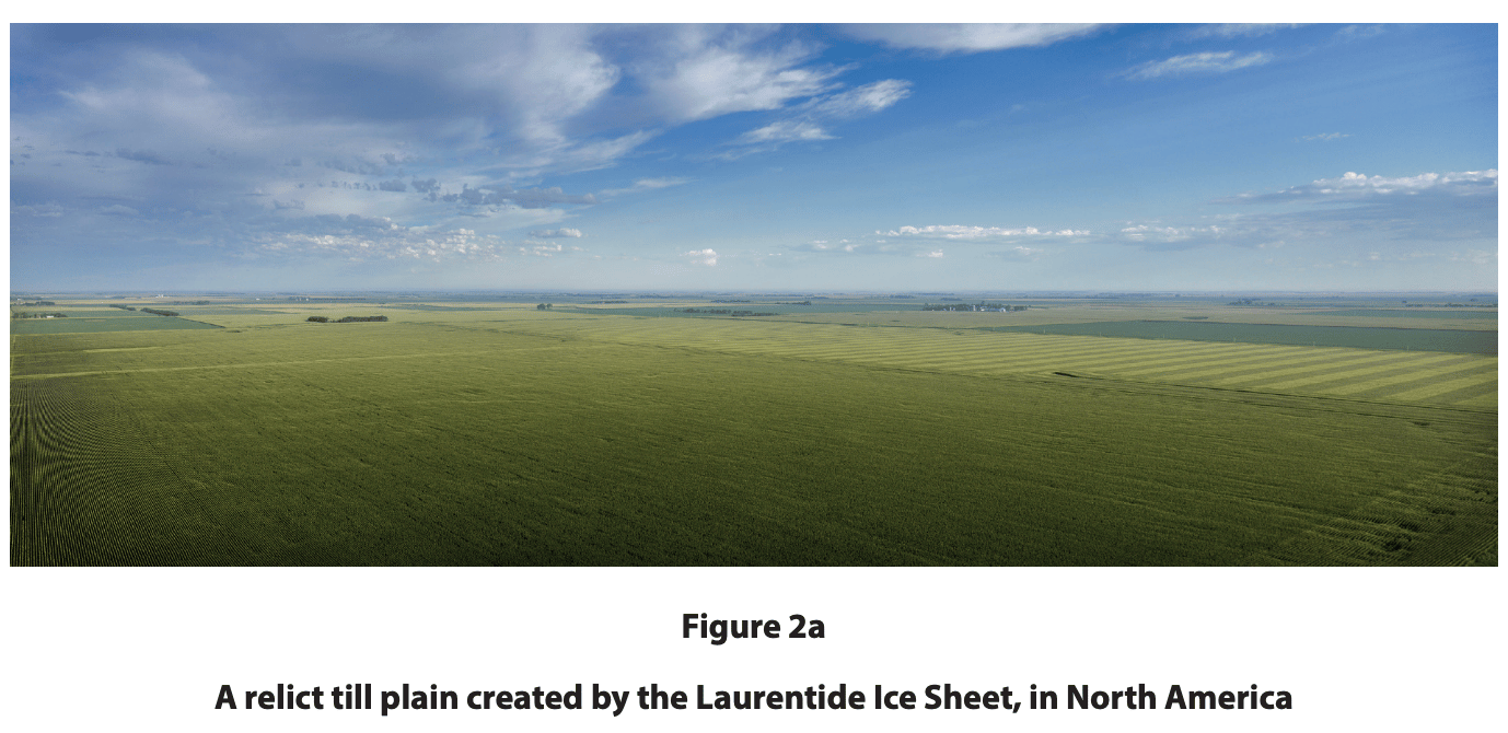
Explain how the processes of lodgement and ablation have created this relict till plain.
Was this exam question helpful?
Study Figure 2b.
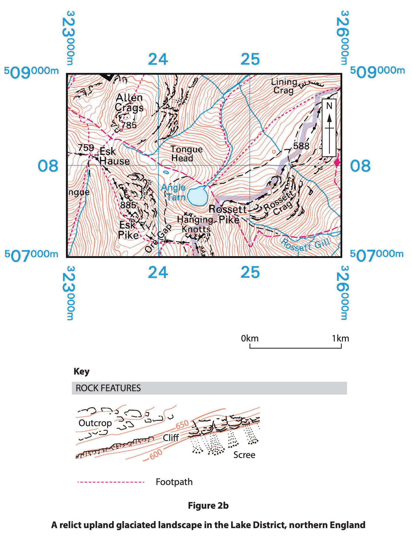
Suggest how glacial erosion has contributed to the formation of this landscape.
Was this exam question helpful?
Study Figure 2a.
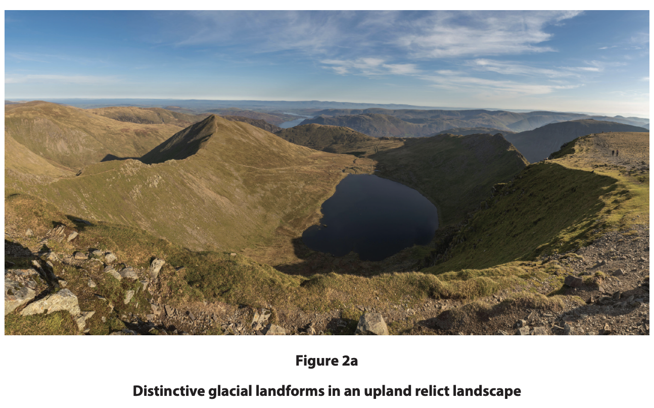
Explain the contribution of glacial processes to the development of these landforms.
Was this exam question helpful?
Study Figure 2b.
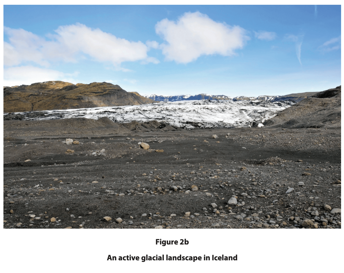
Explain how glacial deposition contributes to the development of this landscape.
Was this exam question helpful?
Study Figure 1.
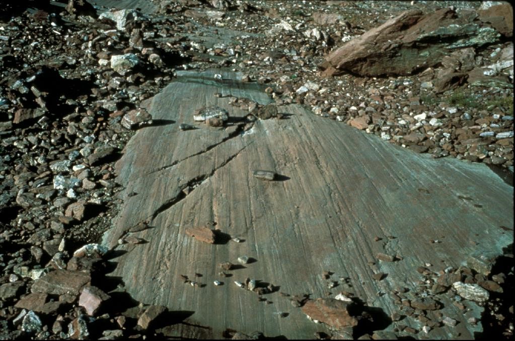
Explain how glacial erosion produced the features shown on the bedrock.
Was this exam question helpful?
Study Figure 1.
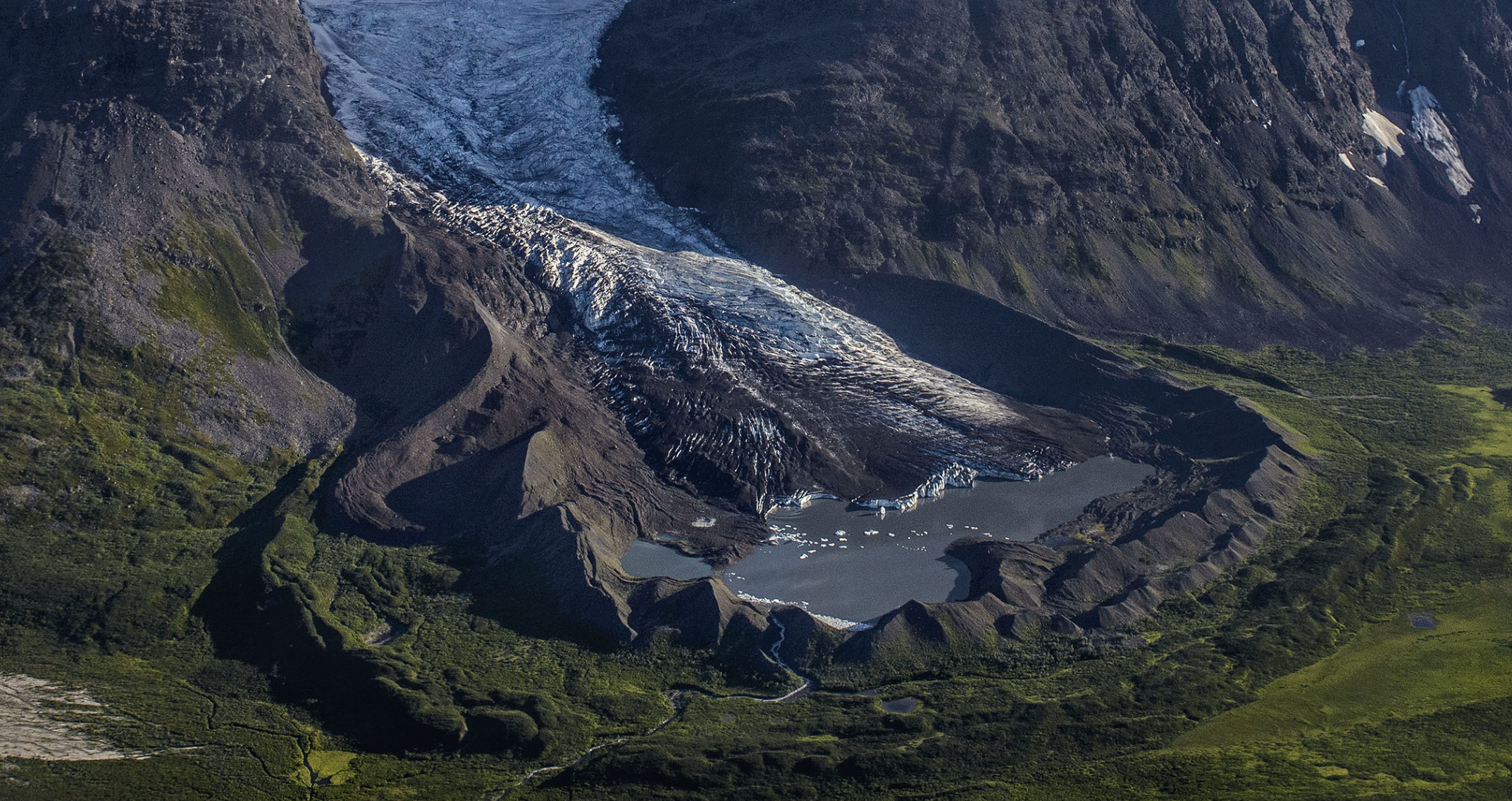
Explain how the moraine shown was formed.
Was this exam question helpful?
Study Figure 1.
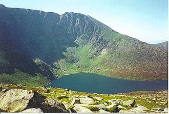
Explain how the landform shown was formed.
Was this exam question helpful?
Study Figure 1.
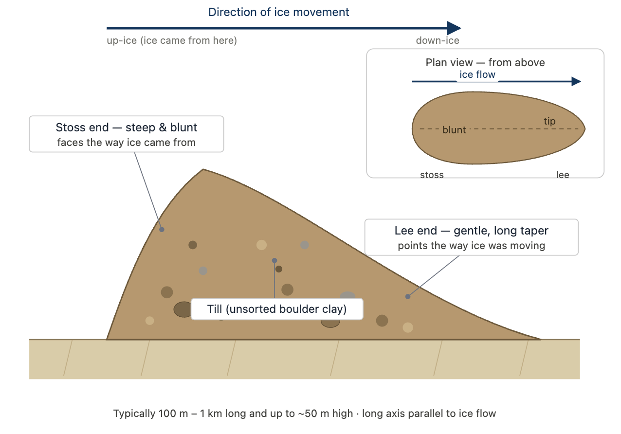
Explain how the landform shown was formed.
Was this exam question helpful?
Evaluate the view that erosional processes are the most important factor in the formation of upland glacial landforms.
Was this exam question helpful?
Evaluate the view that differential geology is the most important factor in shaping glacial landscapes.
Was this exam question helpful?
Evaluate the view that glacial landscapes are shaped more by erosion than by deposition.
Was this exam question helpful?